Thursday, February 27, 2014

Revealed in LIDAR

I was hoping to get out and compare LIDAR images to the actual sites, especially since I have some estimated GPS coordinates.  Unfortunately, winter is hanging on.  There's 6 inches of crusty snow on the ground, and more on the way.  In the meantime, here are some images I have been working on.  Looking at  LIDAR images of familiar places reveals how different types of terrain appear in LIDAR.  This is Johnston Town Forest, looking north from Hartford Ave. I-295 is to the left.


The Town Forest always seems like a wilderness when I go there, but here it looks tiny, squashed between the hill and the highway. Stone walls from farm fields are visible on the hill in the center.  Most of the forest is swamp and marsh, and these appear as very grainy areas colored blue. In the lower center, those "blocks" in the water aren't ice floes, but probably LIDAR artifacts from reflections off the water.
     One of the big advantages of the Grass GIS map viewer  is that images can be tilted or rotated to be seen from different directions or perspectives.  Here's an overhead view of a site in RI.


There's a reservoir to the left, houses along a main road, and walls around a field at upper right.  Here's the same image tilted.


There is more detail in the foreground, and the distant field walls are hard to see.  I can make out two sets of farm walls in the foreground.


These images can be enlarged in the Grass GIS viewer, but the files are so massive, the process is slow and prone to freezing.  Smaller areas can be cut out of the image file in Fusion, and exported to Grass GIS.  Here are the farm walls at lower right.


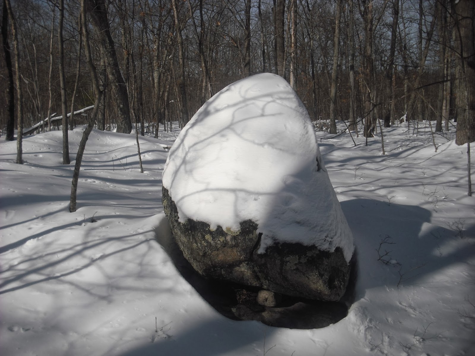
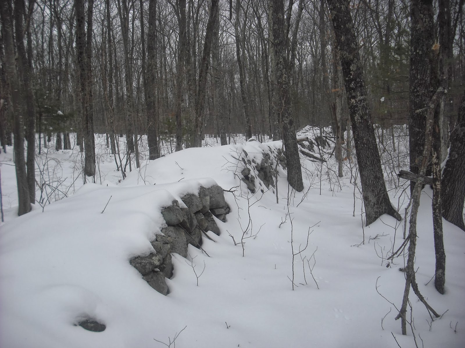
I see a cellar hole and three long walls.


Dirt roads and foot paths also show up very clearly in LIDAR, and I marked them with broken lines.  Aerial photographs from the 1940s show this area covered with forest.  This farm has been abandoned for at least 100 years, and the path to the house is still visible in LIDAR.  There's no trash or fire rings in the area to suggest recent use.  A foot path indicates there's something important at the end, which may be worth investigating. Foot paths also indicate long-term use of an area.  There's a famous cairn field in which foot paths shown in LIDAR seem to branch off to some individual cairns.  This would indicate frequent visits to the cairns, whether to build them stone by stone or to visit them.  Further studies will have to wait until the snow melts.


Friday, February 21, 2014

LIDAR with GPS (Sort of)

LIDAR images are highly detailed, but to be truly useful, there has to be a way to add and extract GPS points from the images.
     The LIDAR images shown on this blog were created using LIDAR data files downloaded from earthexplorer.usgs.gov.  These contain about 8 million datapoints, but so far, I have not been able to find any embedded GPS data. The LIDAR files come in a zipped folder, along with a small XML file containing information about the LIDAR data.  Luckily, this file contains 4 sets of longitude and latitude readings for the four corners of the area scanned for LIDAR data.  When I entered the coordinates for the Copicut area into my topo map program, I obtained the outline of the area.


This footprint corresponds to the one shown superimposed on satellite imagery at the earthexplorer download page.  This is 4950 feet on each side, or just less than 1 square mile.


    This is the entire  LIDAR ground surface for this Copicut area square.  The map color was so garish, I switched to grey.  The farm walls are in lower center.  Indian Town Road runs diagonally across the top.  There are three large pits directly north of the road.


     So, how to get GPS coordinates for points of interest? Eyeballing only works if there are prominent landmarks near a point of interest.  LIDAR images shown in this blog are actually created using rasters, which are data grids with 1500 rows and 1500 columns.  The raster has linear x,y coordinates which are shown at the lower left of the Grass GIS map viewer.  GPS coordinates are in degrees.    The GPS coordinates for the corners are known, so it is possible to write a spreadsheet function generating approximate GPS coordinates from the raster x,y coordinates.


The blue dots are prominent road intersections selected directly in the topo software.  The yellow dots are the same intersections selected in the LIDAR image, with the x,y coordinates converted to longitude and latitude with the spreadsheet function. The LIDAR coordinates are about 60 feet from the original GPS ones. Granted, this is not extremely accurate,  but one would be looking for larger features and areas, not small details.  GPS waypoints generated with LIDAR x,y coordinates for the house, building foundation, bridge and quarry seem to be in the right positions.


I look forward to trying out the LIDAR-GPS coordinates somewhere in RI when the weather improves.


Monday, February 17, 2014

Still More Snow!


Sunday afternoon I went snowshoeing at one of my favorite sites.  All the structures were hidden under the snow, but it was fun anyway.  Having to stay in during snowstorms has given me more time to work on LIDAR.  Here's one little project that gave some surprising results.
     This is South Watuppa Pond, Fall River and Westport, MA circa 1938, in an image downloaded from earthexplorer.usgs.gov.


 Here's a close-up of the area that is now the Fall River Rod and Gun Club.  Its origin as the Borden farm is evident from the number of fields. The old farm house is in the larger clearing. 


A dense woodland starts just south of present-day Benoit Street.  The stone rows in the pond and the rocky little island are not clearly visible, probably due to a combination of high water in winter and low image resolution.
     Here is the same area in satellite imagery from Bing Maps.


The field with a few buildings is still visible, but most of the farm area has been reclaimed by forest.  Meanwhile, Plymouth Boulevard (N-S) and Benoit Street (E-W) have been built and lined with houses.
     LIDAR  imagery shows that many walls are hidden in the forest.


The walls are marked for clarity in the image below, and the rocky little island is circled. Some of the walls correspond to edges of the fields in the 1938 photo. Others are in areas, such as the north edge of the farm, that have already returned to forest.


LIDAR imagery will be even more useful when there is an easy way to extract GPS data from the image files. I'm working on it....

Wednesday, February 12, 2014

Snowshoeing

      Saturday afternoon I made the most of the heavy snow and went snowshoeing.  The woods were quiet except for the drumming of woodpeckers.  Snowshoes were invented by Natives, and  I like to imagine how this winter landscape would have looked to the original users.
     Only large details are visible, such as an effigy I have shown before.


 A wide wall buried in the snow.


I think there's a cairn under there.


At the base of a cliff, I see a propped boulder.  The flat top and height suggest it may have been a work table.  Underneath the propped boulder, I see some large quartz crystals. Maybe the bottom half of the rock was chipped away for quartz, resulting in this table.


I didn't find any grinding slicks, but a closer examination will have to wait until the thaw.


Many popular depictions of Native life show the nuclear family  gathered around the wetu, with Dad teaching Junior how to make arrowheads, while Mom teaches Sis her favorite stew recipe. Archaeological studies have shown that campsites had gender specific work areas separated from the residential area.  These flat propped boulders seem to be the right height and angle for a standing adult to use.  It seems logical that someone doing stone work would stand at a table, instead of risking cuts to the legs while working sitting or squatting. The presence of buried stone chips around these table would prove their use.

Sunday, February 9, 2014

Weetamoo Woods in LIDAR

     Fusion is  handy software for processing  LIDAR data to separate out ground surface and vegetation layers.  However, it was written to prepare ground surface files for use in GIS programs.  As I mentioned in the last post about LIDAR (2/1/2014), one of the drawbacks of working  with Fusion is that only small surface areas may be sampled for 3D visualization.  The resolution can be impressive, but the LDV viewer does not allow for scanning of larger areas.  Recently, I downloaded Grass GIS, started reading "GIS for Dummies" (no kidding), and followed the instructions in the Fusion tutorial and Grass GIS wiki. Here are the results.
     This is the  LIDAR intensity image of Weetamoo Woods in Tiverton, RI.


This shows the footprint of the LIDAR raw data file downloaded from the USGS. Houses are visible to the right, and a stream runs south from the swamp at the north.  Below is the Fusion LDV showing a small farm which I knew to be there.


This area is to the bottom right of the intensity image.   The whole ground surface DTM file was converted to ASCII and imported into Grass GIS.  Here it is displayed in  garishly colored 3D.


The houses along the road show up clearly to the upper right. Lafayette Road is a narrow depression  running diagonally across the upper half of the area. It shows up better in my monitor, but I see two sets of walls.


The one at lower right is the same as that shown above in the Fusion LDV.  The one towards the top is a group of walls just south of Lafayette Road.   This corresponds to my GPS map.


The old farm is at waypoint 1458, and the other group of walls is visible as the blue dots just south of Lafayette Road, including waypoint 1296. There is supposed to be a way to enter GPS waypoints into these GIS projects, and to extract coordinates.  That is another chapter in the "Dummies" book...

Wednesday, February 5, 2014

Moon Hill Corner

Sunday afternoon I took a break from LIDAR and returned to Moon Hill, which I have shown 10/27/2011 and 11/19/11.   Every time I go there, someone has done something ridiculous to the site.  This time it's these fire-blackened rocks piled on top of this propped boulder, and a fire ring directly behind.


The view from downhill.


This is one of the three sites of a corner on Moon Hill.  Looking at this boulder, I see a groove in the side of the stone below the fire-blackened rock.


Maybe it's from tools being worked. A couple of feet behind this boulder is a smaller one slowly being buried by the forest.  There's something suspicious about the edge.


I kick some of the dirt away, and find a nice symmetrical depression, which was probably a mortar. Note the  brightness at the edge of the depression.


This may have been a women's work site for food processing.
92 feet north and on top of the hill is this large boulder propped on bedrock.


And here is the top of this boulder.


There is a shallow depression in the center, and a deeper one on the edge.


I'm tall, but I can barely reach the center depression.  If this was used as a work table, maybe the users sat on top.  Moon Hill does  have a third propped boulder which forms a triangle with the other two.


 The large propped boulder is on top of the hill, with the above propped boulder directly downhill. The propped boulder  with the mortar is to the right near the cliff. I unknowingly painted this corner arrangement and posted it 11/19/11!


These hilltop work sites usually have very good, unobstructed views of the surroundings.This probably had some defensive purpose.


Saturday, February 1, 2014

An Old Farm in LIDAR

Deep in the woods in Tiverton, RI is an old farm. A well-made wall marks the boundary.


Beyond are some evocative structures.  Loose stone rows are visible under the leaves.


I have heard that loose stone rows were  created when a farmer threw rocks against a wooden fence while plowing the field.
     There are more  walls and large rock piles further on.  These have a variety of stone sizes, with the largest at the bottom, and look like someone tossed the smaller stones on top.


These don't have the very neat, symmetrical appearance of cairns at other sites, and may have been constructed by a farmer clearing fields or storing stones for use in the walls.


Here's the old farmhouse  foundation, and  the same place in LIDAR. I increased the image contrast to show more details.


 The farm is at lower left.  Walls are visible, with the farmhouse foundation inside the larger enclosure.  Directly south is a smaller enclosure containing the large rock piles shown above.  An old farm road runs across the site directly to the north of the farm. There is also an old path that runs north to the farm road.  LIDAR shows paths even if they are not worn very deep into the ground.  Maybe the denser soil  in a path or road is detected.

     All the LIDAR images I have shown were created using the Fusion LDV, hence the USDA Forest Service logo across the top. In my last post, I mentioned that Fusion can convert surface files to JPEG or TIF images.  The TIF ground surface images are flat and hard to read. JPEGs created with the Intensity Image command are grainy, but at least have much more detail and are useful as reference images.


This is the larger area containing the farm.  Houses and streets are visible to the right.  A brooks runs south from  the dark swamp at top center in the image.  Other swamps and ponds are visible as dark areas.  The yellow and red lines are topo lines created using the ground surface layer data and colored  for contrast.  The brook appears white in the center of the image because the LDV is sampling that area.
   Fusion is easy to use and allows quick sampling and visualization of small areas, but does not support export of high-quality images.  It was designed to produce ASCII and DTM files for export to ArcGIS, a mapping software package.  Unfortunately, ArcGIS is quite expensive, but the open-source Grass GIS is also designed to work with these file types, GPS input, and raw LIDAR data.  I am trying it out.  This may take a while...