Wednesday, May 29, 2013

Water Flow Across A Landscape

Somewhere in the woods of northern Rhode Island, a row  of  flat rocks extends down a steep slope and ends at the bottom.  A possible purpose for this row is suggested in the spring, when snow melt forms large pools of standing water.
Water makes trickling sounds as it cascades down the rocks, and then vanishes into a mound obscured by a rotting tree.  I  first found it by following  the sounds.  One would expect the ground around the end of this stone row to be wet, but it never is.  This structure may be a drain.  The stone row collects the water, and channels it into a drain of stones buried under the soil.
Above we can see where the running water has melted the snow.  Below is a clearer picture from 2008.

Some may say that this  was created by water eroding the foliated granite, leaving a trail of fragments.    However,  since the water disappears into a mound at the bottom, this was  probably built for drainage. These were  built by farmers, but I imagine that Natives may have also built them to keep their fields from getting swampy.
Here is the view from the top, with the water passing under the rotting, fallen tree. Below is the  interesting view from the top with a dirt road, a wall, and what looks like a small manitou to the left.
 Evidently, the farmers and the Indians before them controlled the flow of water across the landscape. 200 feet away is an old well next to a  small building foundation. About 90 feet from this well is a large stream.
I have heard this type of well described as an "Indian well", but it never made sense to me why an Indian would go to the trouble of digging a well when fresh water was an easy walk away. My guess is that farmers dug the small wells in this landscape because their livestock contaminated the streams.


Wednesday, May 22, 2013

Inside Niches


Sometimes I find niches with manitous or other stones standing inside.   Stone was removed from this outcrop in northern RI, creating a "roof".  A manitou was propped up in the resulting niche. 
Here is a larger view. There don't seem to be any alignments.
 This is the view from inside the niche, which faces south. 

The foliated granite in this area splits easily, and thin slabs are often found in areas with quarrying. Previously, I have suggested that some manitous are thin quarried slabs that were stood up to prevent breakage (1/9/2013 ).  However, this stone-in-niche arrangement occurs elsewhere, such as this one on a rocky slope  facing  east.

Here is another one, in a cliff which faces west over a swamp.
These last two stones are not thin slabs, and someone set them  inside these niches.  It is easy to imagine these as shrines, since figure-in-niche imagery is common in churches.   Perhaps these stones were placed as an offering or message to the spirit world.

Wednesday, May 15, 2013

A Site With Cairns

Somewhere in northern RI is this group of stone structures at the east face of a steep slope.   Some may have been built by Natives, and others by farmers. The first group, right off the trail, is what appears to be a niche with a pointer directly below.  The pointer points east, towards a swampy area. Pointers may indicate a large structure in the distance (2/22/12).  Unfortunately, any larger structures beyond the swamp have been lost to development.


The niche has smaller stones inside. It is easy to imagine this is some sort of shrine, especially since this figure-in-a-niche imagery is common in churches and on front lawns.  Perhaps the Natives who built it had a completely different interpretation.
     There are some cairns directly downhill from the pointer.


The largest has a dimple, which is uncommon in this area.
There are a couple of possibilities for this depression.  Someone long ago was looking for "treasure" in the cairn. Another possibility is that the dimple is built into a large cairn.  As the cairn gets larger and wider, it is easier to stack the larger stones up on the perimeter than to lift or toss them  to the center.  Note how neatly the stones are stacked to the left on the pile.  Maybe the final stage of this type of cairn construction involves tossing smaller stones into the center. This area is an old farm, and  it makes sense that the larger stones would be cleared away before the smaller ones.  Or maybe there was some ceremonial purpose related to the niche and pointer. There is no way to be sure.
     About 250 feet north of the cairns is a strange little structure, a short wall  with some sort of niche built into the slope. The wall is about 7 feet long and 3 feet tall.

 Here's the niche
 Here's a view from the inside.  There is nothing interesting on the ground.
Perhaps poles were anchored in the niche and rested on the wall, creating a temporary shelter.  Since it is against the slope, it would have been wet in the rain. Maybe supplies were stored off the ground inside it, or it was a small  pen for animals.


Wednesday, May 8, 2013

Meditation Seats

Here is a small enclosure behind an outcrop in an area of Tiverton, RI, with many walls. The structure is about four feet across and  has partially collapsed. 

A  side view.
This is too small to have been  a house or storage shed.  There is no water nearby, so it was probably not a sweat lodge.  There don't seem to be any solar alignments, either.
 In the background is a wall

What could this small structure be?
Here is another small enclosure in RI, in an area with many cairns, as well as  building foundations and quarries.


Here is one in  Sharon, MA,  near an old cabin. This one is constructed of stacked cobblestones and decorated with a rusty oil drum.
 Here is another of these enclosures, presumable from a later period since it is constructed of  cinder blocks.


And here is what these might have been. If this wooden outhouse was removed, the outline of bricks and stones in the foundation would be very similar to those above.  The door side of all these enclosures is open.
Although the first enclosure shown above is partially collapsed, it is easy to imagine the wooden outhouse structure resting on the stones, with the large stone to the left acting as a step to the door. A Google Images search of "prayer seat" turned up many images of these square-cornered small enclosures from the northeast.  I even saw a small squarish stone enclosure at the Pequot Museum at Foxwood, in a reconstruction of an early 19th century reservation farm site.  The marker said the purpose was unknown.  Once every farm had at least one. The prayer seats shown in Mavor & Dix are rounded. Maybe these square structures should be called meditation seats, since they supported a  "Meditation Room".

Wednesday, May 1, 2013

August 13 in April at Miantonomi's Cave

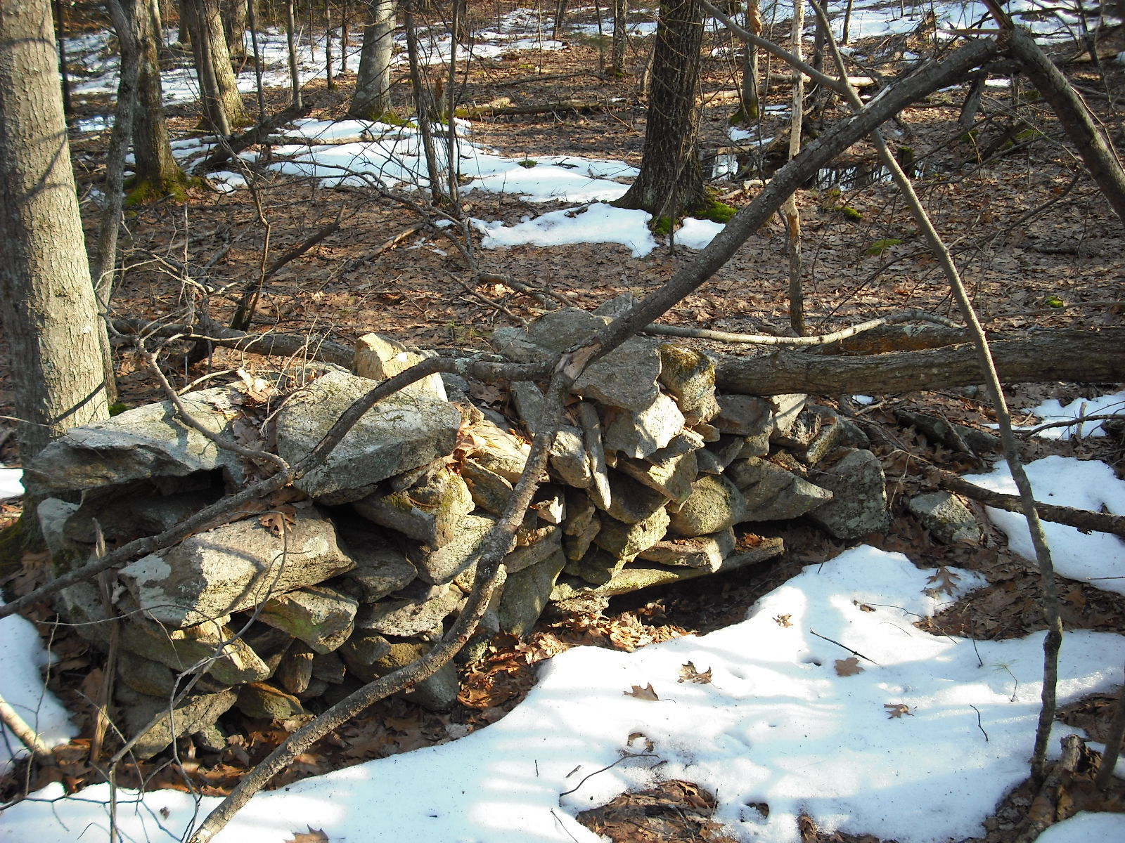
     Recently I returned to Miantonomi's Cave.  
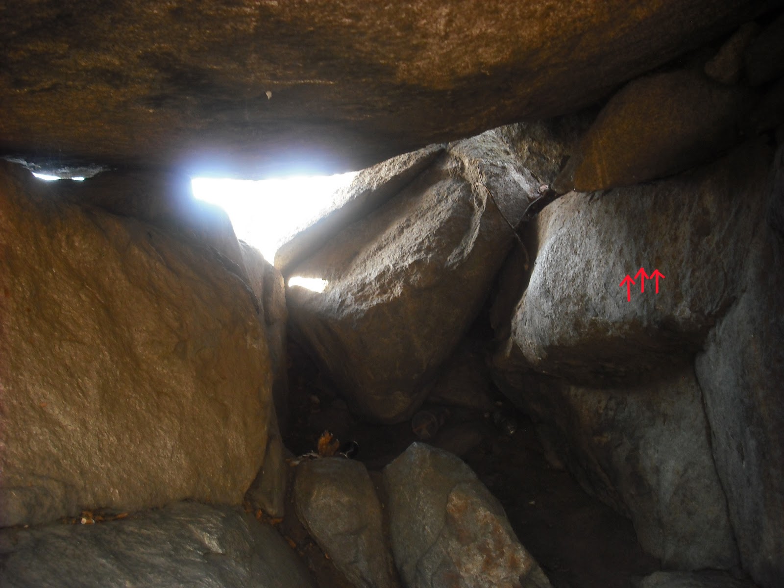
Here is a close-up of the  mark on the cave wall that was touched by the sun dagger in the equinox (almost) time lapse video (3/30/2013).  These two pieces protrude about 0.5 inch above the cave wall, and are about three inches apart.
 They are directly under the projecting stone.
The sun sets at the same position on the horizon twice every year, except for summer and winter solstices. There are 54 days from June 21 to August 13, and from June 21 back to April 28.  On April 28, the pattern of sunlight in Miantonomi's Cave would be similar to that on August 13, but there would be no foliage blocking the sunlight.  First  I returned on April 26.  The sky  was sunny when I left my home, and by the time I reached Miantonomi's Cave, it was obvious that Nature was not completely cooperative. This experience made me appreciate the difficulties of using sun patterns for determining important dates.
Luckily, the clouds kept breaking, and I obtained some photos and time lapse video. I returned on April 28, and this time, the clouds held off until about 6:45 PM.  The best pictures from both dates follow. The sun enters the large window first through the notch around 5:26 PM,
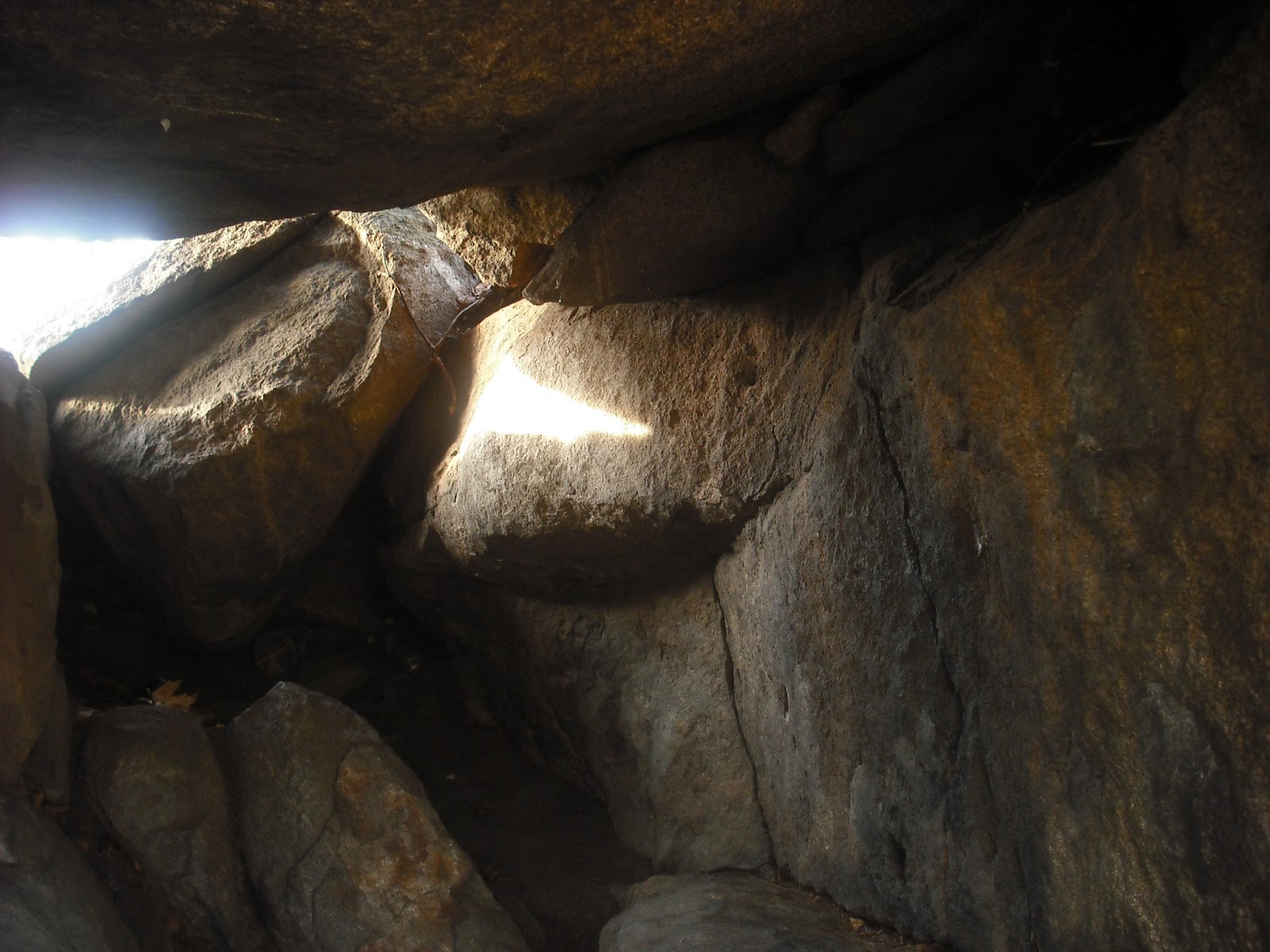
and then forms a large dagger that touches the first dimple around 6:30.  The dimples are marked above.
Around 6:35, the dagger touches the second dimple, and the second sun dagger appears. It is formed by light entering through the small window.
This second sun dagger moves upward, touching the crack in the wall.  The final pattern occurs at 7:04, when the light from the large window touches the end of the projecting stone.

It is easier to get a feeling for these events by watching the time lapse video made  4/26/2013. Clouds kept going past the sun,  making the sun daggers vanish and reappear, but the final sequence is clear. The video made 4/28/2013 shows the sequence of the sun dagger touching the dimples and the second sun dagger appearing and moving up the wall until the clouds blocked the light. The first sun dagger seems to disappear briefly after touching the second dimple. This also happened on 8/13/2012.  This was not caused by passing clouds, but probably by trees outside the cave.
     This is essentially the same pattern as on 8/13/2012, except then the foliage kept diffusing the light, instead of clouds.  I suspect there are two marks for equinox, and three dimples for August 13, to allow for estimation of days to these events, in case of cloudiness.

      I always notice something new whenever I return to the cave, something revealed by changes in light or season.  The projecting stone resembles an animal head from the side.  This time I  noticed something shiny along the line for the "mouth".  It even looked like there was a drop of water at the end of the stone.   The shiny area felt smooth, as if there were crystals there.


The veins of crystals are marked above.  Maybe this stone was chosen because the effect is like teeth shining in the half-light of the cave.
     Only 50 more days until summer solstice....