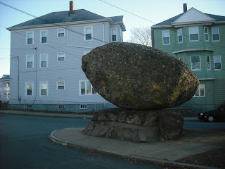
Rolling Rock in Fall River is always an incongruous sight, a massive puddingstone boulder surrounded by three-deckers and traffic. The pedestal it stands on was once part of a large outcrop that was quarried away. There used to be a deep pit in front of it that was the scene of drownings until it was filled in.
Old maps show it as a landmark, on the main trail which ran from the
falls of the Quequechan up present-day Pleasant Street, County Street, and then to the
Narrows. An old campfire story claims Rolling Rock was
used by the Wampanoags to crush their prisoners. While this is
possible, I doubt this story. There are many gruesome descriptions of
torture written during King Philip's War, but not a single one describes a
balanced boulder used this way. Could these rocking stones have been
used for some sort of tribal rite of passage? Perhaps, but no evidence
is found.
Mavor and Dix had their own interpretation of Rolling Rock in Manitou.
"We imagine that the
boulder could have been used as a signalling device, as rocking it in
sunlight about its axis, which is oriented ten degrees true, would cause
changes in reflective patterns when seen from the east and west."
Using a large stone as a visual signalling device
is most likely ineffective, because someone has always to be watching for changes,
and it won't work at night. Also, from the Quequechan Falls to Rolling
Rock is about two miles, as is the distance from Rolling Rock to the east
shore of North Watuppa Pond. Any changes in the rock would be hard to
pick out, because it would appear quite tiny at that distance. Rocking the boulder may have generated loud sounds and vibrations through the ground, which could have been used as signals. Rolling Rock has been fixed in place since the 1930s, so there is no way to test this.
Or maybe the significance of this stone is simply that it rocks.
I have often wondered how Rolling Rock looked originally. Here we may take a walk past the rock and down to the falls on a warm summer day.
Wednesday, May 28, 2014
Thursday, May 22, 2014
Return to South Watuppa
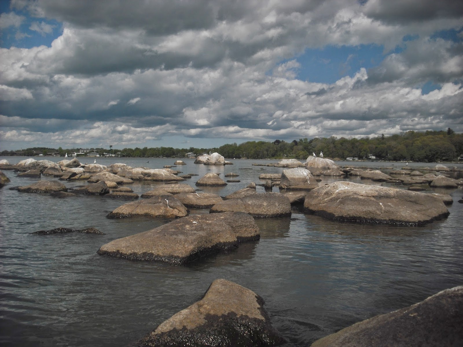
Wednesday I had the day off, and since it was a warm, sunny day, I went kayaking on South Watuppa Pond. With no other boats or jet skis about, it was a very quiet afternoon. Here are the stone rows at the Fall River Rod and Gun Club.
The rocky little island has only a covering of thin, dry reeds. Later in the summer there is a dense blanket of tall grasses. More of the island's features will be visible this afternoon.
I always have to stop and see the flat rock with grinding slicks.
It is so quiet today, there are two blue herons watching me from the shore.
Over in the Christopher Border brook, a swan is doing sentry duty, swimming back and forth while keeping an eye on me. Usually they avoid humans, so this is a good time to show some respect. Despite their serene appearance, swans have been known to attack people who approach their nests.
While making my retreat to the rocky island, I see this lovely view to the north.
The island has birds roosting, as usual.
And with less vegetation, I see what looks like a small propped rock, and a grinding slick to the right.
Over 200 years ago, the pond was at least two feet lower, so the grinding slicks and stone rows would have been on dry ground. Perhaps they were once parts of summer campsites used by the Pocassets, like the picnic tables and barbeques installed at state parks.
Friday, May 16, 2014
Stony Fort in LIDAR
Alas, rain has postponed today's outing, so the exploring will be virtual. Recently (5/5/14), JimP posted some satellite imagery of a possible Indian Fort on the rockpiles blog. This area is a few miles south of Queen's Fort in Exeter, RI.
This site near Wolf Rocks Road appears as a loose semicircular arrangement of stones about 500 feet across. The piles at the center of the arc are quite large.
Satellite imagery makes the ground look flat, and tree cover obscures details. Raw LIDAR data is available for this area. Here is a LIDAR scan of the site showing the contours of the ground with no z-axis exaggeration.
The mounds of rock in the arc are clearly visible. There are also some trails and old dirt roads at the northern edge of this area. There appears to be a large depression in the ground inside the arc.
Here is the view from the east.
Drawing a transect across the area from south to north gave this profile.
Clearly there is a steep slope to the south, then a deeper area and the slope of the hill to the north. It is not likely that a depression surrounded by rocks would have been used as a fort. The area inside the semicircle of rocks could have once been a gravel pit. Of course, there could have been another stony structure used as a fort, or suggesting a fort, which was mentioned in local land records.
Wednesday, May 7, 2014
My Trip to Purgatory
It was Purgatory Chasm State Park in Sutton, MA. This is a chasm containing massive stone blocks that were tumbled in by meltwater from the last glacier. It is 70 feet deep and about a quarter of a mile long. Purgatory is an appropriate name, since it is a difficult hike over all those massive blocks, and the chasm has been the scene of a few deaths and plenty of injuries.
Purgatory Chasm is a very impressive place, suggesting the power of nature. Even on a warm day it was quite cool inside, with some ice remaining under the boulders.
Some of the cliffs resemble eagles or other animals.
In all this jumble of boulders, it was hard to find any large propped boulders or manitous. However, there were a few interesting small details.
Perhaps this is a niche on the south side above the chasm.
A young bent tree points towards Purgatory brook.
Here is a mortar that was used by the Nipmucs.
I found an old image of the sign that was behind it, which states this mortar was originally on a knoll near Lackey Dam, and was moved here by some community organization. Close by is Slanted Rock, which the kids were using as a slide.
Despite the sign, I can still imagine the Nipmuc mothers using the mortar, and being able to keep an eye on the kids at play.
Tuesday, May 6, 2014
Subscribe to:
Posts (Atom)


