Thursday, December 29, 2011

The Lookout

 Somewhere in northern Rhode Island is this steep hill with a south-facing slope covered with boulders.

Just below the crest of  this hill stands this strange enclosure.
There is enough room to stand between the smooth bedrock wall and the stacked slabs in the center of the photograph.  Once inside the little enclosure, one can look out between two standing slabs and see a wonderful view to the southwest.
Directly in front of the enclosure is a supported slab.  There are only a few rocks underneath it.

Here is the view from directly above this structure, showing the slabs. The top edges of the enclosure slabs leaning against bedrock are visible in the center of the photo.

 Bent trees indicate the importance of this structure.


Since there is no good vantage point for a photograph, I have drawn an exploded view of the enclosure. The bedrock wall is pushed back. 

The top of the horizontal stack of slabs is about four feet from the floor. The end of the supported slab is visible on top of this stack.
Perhaps this enclosure had some spiritual purpose, suggested by its facing southwest.  Unfortunatly, there are  few structures left on top of this hill. Industrious vandals have converted a a cairn into a fire ring with benches.
n
 Some rocks remain on top of the outcrop behind the ruined cairn.

Thursday, December 22, 2011

Winter Solstice

Two years ago, I was crossing a hilltop on a December afternoon, and I noticed that this line of boulders was aligned with the shadows.
Some of these photos were shown on Larry Harrop's blog at the time.  Further exploration of the site revealed that this line of boulders intersected another line of boulders, one of which was propped.
Here is the second line of boulders, with the propped boulder in the foreground. Below is the strangely shaped top edge of the stone in the center of the  photo.
The angle of the first line of boulders is consistent with winter solstice.  There is no chamber or enclosure up here, so I don't know the observation point.  Piecing together the site from photographs, I made this painting of winter solstice.

Monday, December 19, 2011

King Philip's Rock

This site in Sharon, MA  is believed have been a rendevous point for King Philip (Metacom) and his chiefs during King Philip's War. It is a jumble of huge glacial erratics with some impressive propped boulders.
Here is the most impressive boulder, an erratic propped on two others.
Here is a propped boulder that seems off-balance.
Here's another propped boulder. The surface to the right does not contact any supporting boulders.
The plaque at the site says that King Philip's War led to the extinction of the Indians.  This bent tree pointing the way  to the site indicates otherwise.


Wednesday, December 14, 2011

King Philip's Cave

King Philip's Cave in Sharon, MA, is a structure of massive boulders that has astronomical alignments.  It is thought to have been used by Native Americans for determining solstices. Some of the stones show chipped edges, suggesting they were adjusted for correct alignment.  This site was the subject of an intensive study by Ballard and Mavor (2006) here.    I  recently visited this site and took many photographs.
     Here is an overview of the structure, approaching from the south.
 This is the view from the north.

Here is the opening for summer solstice, with the bisecting boulder in the center.  Note how the edges are chipped.
There is enough room for an adult to squeeze past this boulder. At the back of the chamber is a large slab that has been  chipped to make a triangular opening where it touches the ceiling.  The back of the next chamber is visible through this opening.

A nice view of the bisecting boulder on the way out.
Here is the opening for winter solstice.

This is the same slab which appears in the article, but the picture angle is slightly different.  There is more graffiti, and  someone touched up the swastika.

There are other interesting structures in the area, such as this huge propped boulder.  This may be the one that the Sharon Conservancy trail guide calls "Moon Rock" because of lunar standstill alignments. What is most impressive about this site is the level of mathematical skill required to create aligned structures  to mark fleeting yearly occurrences. 
 A nearby hill has more structures with alignments, but too many for one afternoon!


Thursday, December 8, 2011

Landmarks

A few years ago, I was wandering through Snake Den looking for art subjects.   I started noticing that large boulders and outcrops with striking shapes often were surrounded by piles or rows of stones.   An online search of "stone structures" led me to Larry Harrop's blog, and to the realization that the mysterious structures had some aesthetic or spiritual significance to the Native Americans who built them.
     Here is an example.  A few weeks ago, I noticed this large outcrop, which  looks like granite boulders joined eons ago by the lava which flowed between them.  The lava cooled into layers, which resemble flowing drapery.
Investigation of this site revealed a loose stone row running  about 140 feet from the top of the outcrop to a large boulder at the edge of the hill. There is a standing stone in the middle of the stone row.

.
The end of the stone row, at a large boulder.
The photograph of the outcrop, with heavy shadows, was disappointing.  Perhaps the significance of this site is how the lava vein seems to rise from the earth and permeate the boulders. Here is my interpretation, in oil with lots of palette knife work. I used a little artistic license and added red and gold to the lava flow.
 I have always noted that trails go past prominent stone structures and stone rows.  These might have been waypoints or boundaries along a native trail system. They may have had spiritual significance, and been the equivalent of roadside shrines. Looking at the layout of stone structures and stone rows in an area, one can imagine a network of trails, but development and disruption make it impossible to be certain.
     Here are a couple of landmarks from an old native trail, now Route 44 through Rhode Island.  The first is a large boulder on bedrock in Smithfield.  The second is a pedestal boulder on a small hill on private property next to 44 in Harmony.  Our roads are built on a secret landscape.

.


Thursday, December 1, 2011

Praying Indian Village Site

Somewhere in Massachusetts is a site that may have been one of the Praying Indian villages that John Eliot organized.  After over 300 years, all that is left of  the  Indian presence  is a few stone structures.  The most impressive site is marked by a boulder on an outcrop.
The boulder is not propped, but has a very small footprint.  Perhaps it was intended to rock.
Uphill from the outcrop stands a stack of flat stones.
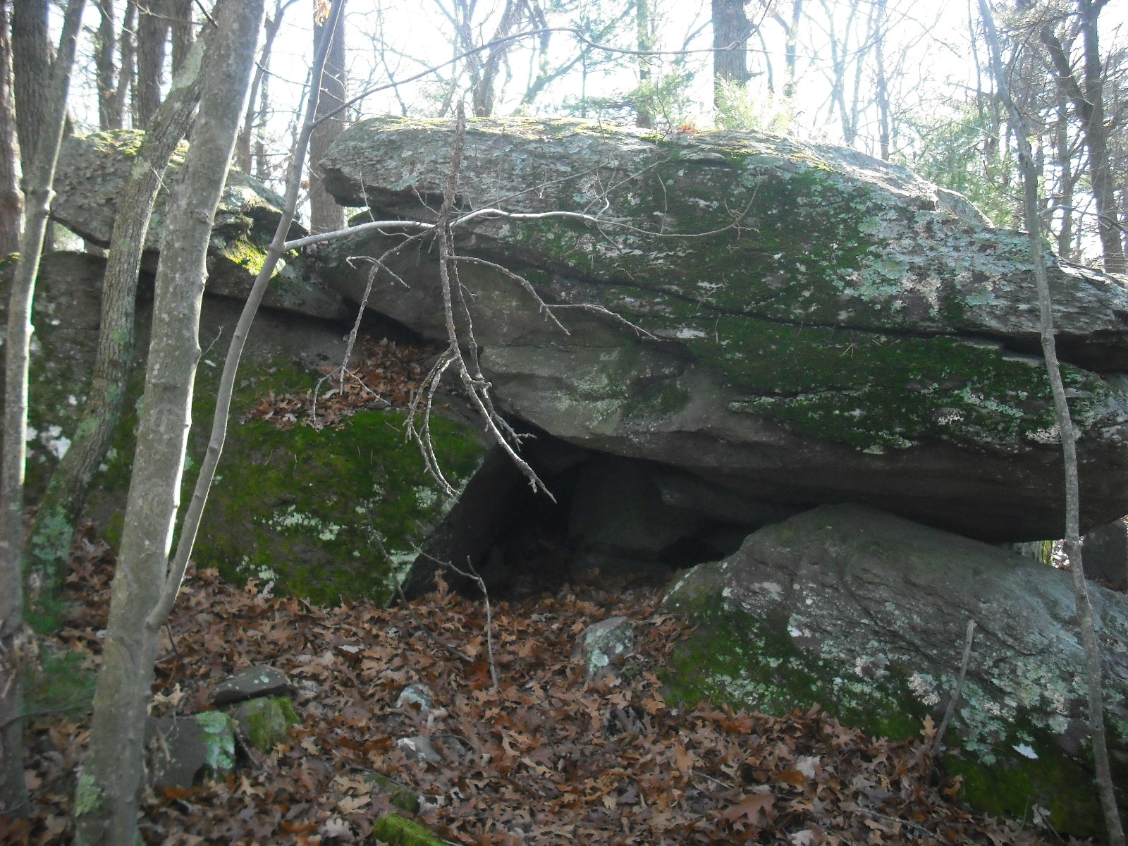
Behind some young pines, I notice a strange boulder.  Part of the top half of the boulder has broken and shifted forward, creating two openings.  The shifted slab is visible in the middle of the photograph of the southwest-facing side of this structure.  There is a manitou in front of  the opening on this side.
Someone has placed a small manitou  below the junction between the slab and boulder.  Also, rocks have been jammed into the junction, presumably to stabilize the slab.
On the northwest-facing side, the shifted slab and a small opening are clearly visible.


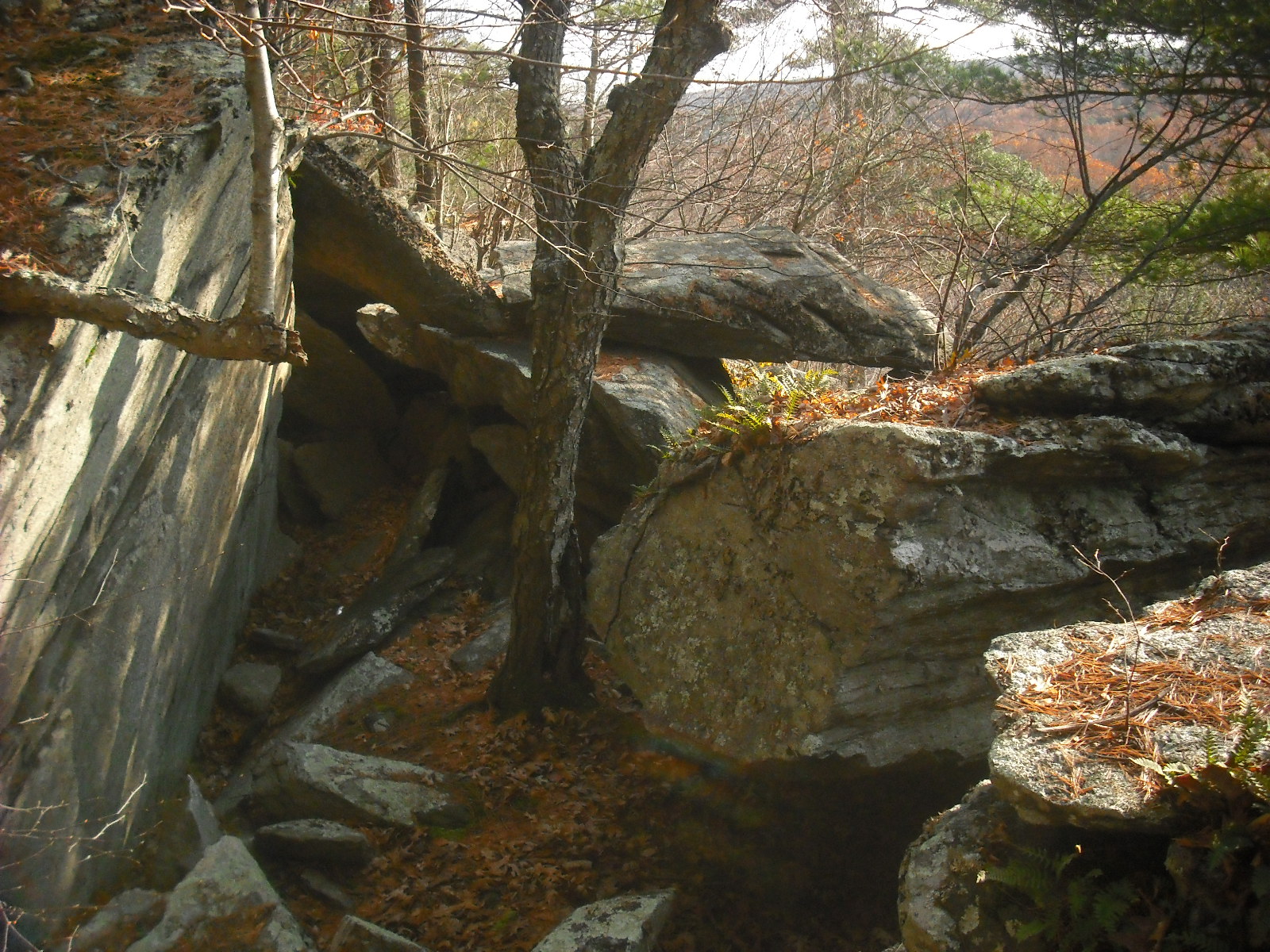
Since this structure is surrounded by young pines, it is impossible to get a good photo of the entire structure.  Piecing together the photos, I came up with this drawing.

The shifted section at the upper left is wedged against the rest of the boulder with smaller stones.  Directly below this section is a large, roughly heart-shaped slab of stone leaning against a boulder.  The manitou is directly behind the propped rock in the foreground.
     Downhill and near the outcrop are a few low cairns.  One is topped with a manitou.
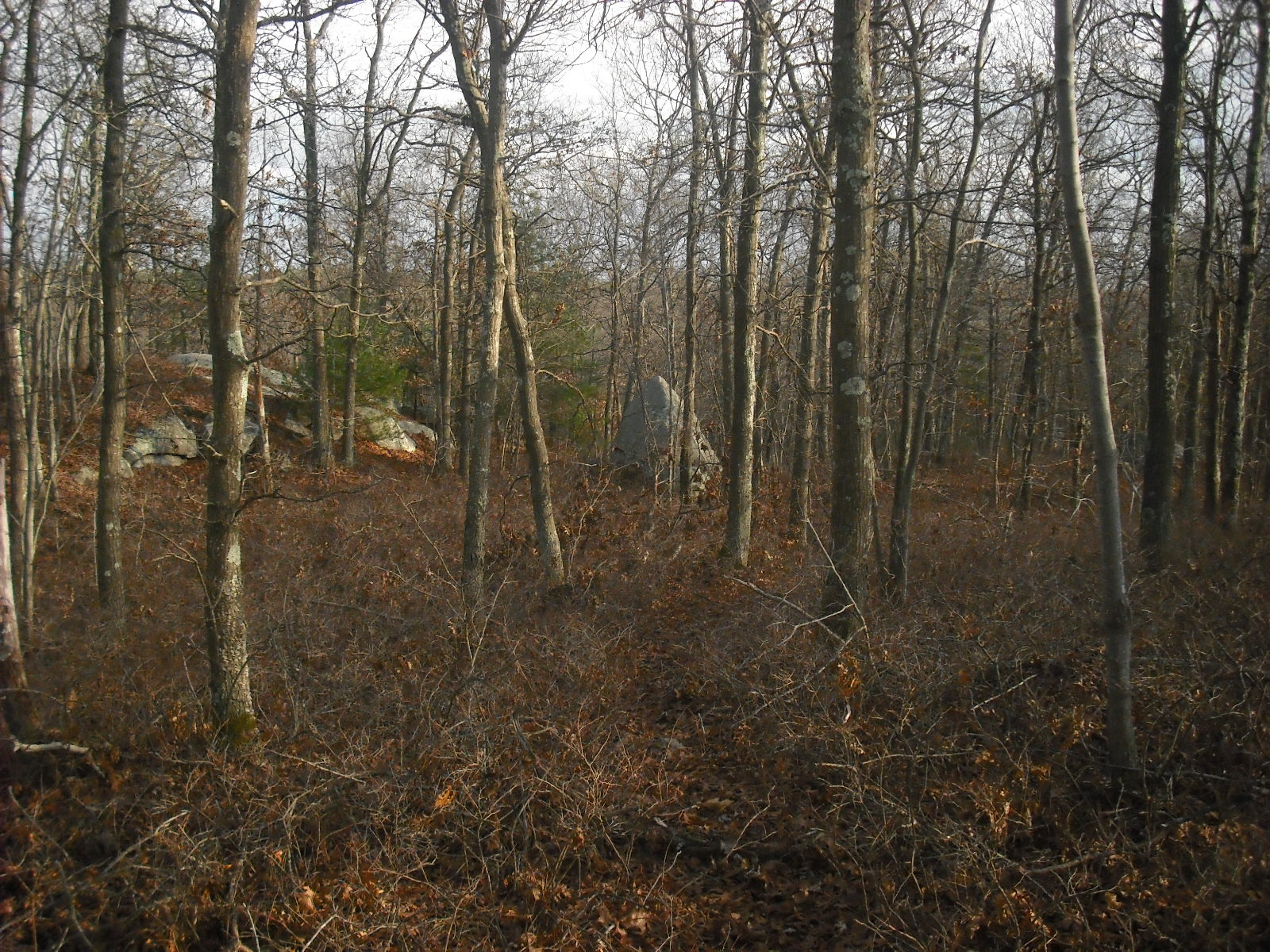
Here is the entire site on an early  spring day.


Wednesday, November 23, 2011

Enclosure and Bird Effigies

Somewhere in northern Rhode Island is a beautiful hill composed of jumbled  boulders.  On the shoulder of the hill is this boulder carved to resemble a  bird.
This photo was shown previously on Larry Harrop's blog.  The bird faces SSW towards a small, square enclosure built against a large boulder.  One wall of the enclosure continues about 100 feet away from the enclosure, until it ends at a hay field.
The enclosure is too small to be a building foundation.  Here is the whole enclosure, showing a small opening to the right.

What is the purpose of this enclosure?  The wall and nearby structures give a clue.  The wall is at a 253 degree bearing, suggesting a winter solstice alignment.  The enclosure may be a vantage point for observing astronomical events.   Unfortunately, if there were any other alignment markers, they were cleared from the field.  However, beyond the field and along the line corresponding to summer solstice is a large cairn field,
an outcrop,

and finally this huge bird head effigy.
 The presence of cairns and effigies at locations corresponding to alignments suggests annual ceremonies linked to these events.  I suspect that the use of small enclosures as vantage points in solstice observations was once widespread.  The reconstructed Pequot 1720 homestead at the Pequot Museum at Foxwoods shows a small, square enclosure that was found at Indian farm sites on the Mashantucket reservation.  The accompanying sign said its use was unknown.
     There are two hill top sites with astronomical alignments marked by large boulders in this northern RI area.  Perhaps these were used by the Indians before the arrival of  Europeans. After the Indians lost most of their land and moved to small farms, they may have built small enclosures and walls with alignments to continue their customs.  These inconspicuous structures would help keep these practices secret from their white neighbors.