Wednesday, January 30, 2013

Lunar Alignments

I revisited the double boulder site I posted last week (1/23/2013) to see if there were any other alignments. Assuming that boulders with alignments are marked with small round holes, I checked this boulder.


Perhaps the single hole means moon.   It is about one inch deep.


Directly to the left of this boulder is this large split boulder.


The face of the split boulder has also been marked  with a chisel.


The alignment parallel to the smooth face is 310 degrees, suggesting lunar standstill.  Observing  the moon on the horizon by sighting along the smooth rock face would be fairly accurate, especially since there is only a low swampy area in this direction.


The bearing facing from the split boulder towards the double boulders is 130 degrees.  Maybe lunar standstill moonrise is observed over the peak formed by the two boulders.

This site is wide and level, on a hilltop with a commanding views.   It may have been an observatory  for stellar and lunar events. There are probably more alignments that I haven't found, or that were destroyed over the years.  This site  must have been beautiful at night before light pollution hid the Milky Way and fainter stars.


Wednesday, January 23, 2013

Pleiades Observation Site

About 60 feet north  of the two propped boulders  in the previous post (1/16/2013) is a large propped boulder with some striking marks.

On the other side (north face) is a small inverted triangle, about 6 inches across at its widest part. It looks like the sides of the triangle were made by working holes into the rock.
There are also  some small round holes, similar to those in the large slanted boulder at Miantonomi's Cave.  There are two larger ones to the left on the north face,

and about five smaller ones to the right in a line extending from top to bottom.

This boulder has been marked with stone tools, for some unknown reason.
     The inverted triangle may have symbolic meaning.  Since the right-side-up triangle at Miantonomi's Cave seems to point to a huge triangular boulder in the distance in front of the cave, the inverted one could point to something behind the boulder.  Here are two possibilities:
This propped boulder, which is about 50 feet away.
 Or, following the logic that the inverted triangle refers to a boulder shape, it could refer to this impressive boulder about 2300 feet away. There also are metal chisel marks on the bedrock beneath it.
The bearing of this boulder from the marked boulder is about 318 degrees, suggesting summer solstice sunset and Pleiades set.  Now the pattern of holes on the north face of the propped boulder makes sense, as a diagram of the Pleiades.
     Here is a sketch, since it is hard  to photograph details on a large, shaded boulder. The larger holes to the left correspond to two brighter stars. This constellation is portrayed nearly vertical, instead of horizontal, as on page 47  of  Manitou.  This may simply be the native understanding of the Pleiades.
The Pleiades were very important in Native mythology, and their rising and setting were used to time agricultural practices.  There may be other alignments with the moon and stars at this beautiful site. Perhaps these events were viewed rising and setting between the two boulders.


Wednesday, January 16, 2013

Stone Work at a Propped Boulder Site.

A few weeks ago, I visited one of my favorite sites,  two huge propped boulders on bedrock.  Although they are defaced with graffiti, they seem primal.
These boulders appear to touch, but do not.  They are two halves of a massive boulder, propped up on feet. A few years ago I digitally rotated the outlines of the two flat faces, and found that they were not opened out like a book.  Instead, the one to the right was rotated about 180 degrees relative to the other.
Someone may claim that the boulder was dumped here by the glaciers and split naturally, and natives propped the halves as a shrine to the powers of nature.  To me, this seems likely.  However, the site has been worked in historic times: there are a few tool marks on the boulders.
The oblong mark in the photo directly above looks like a chisel mark.  Examination of the bedrock  in the late afternoon sun shows small gouges in the smooth, flat rock. These are 3-4 inches long, and 1-2 inches deep, with sharp edges.

 These are probably marks left from use of a flat wedge or cape chisel. These are metal tools, indicating that stone was removed during historic times.
On the bedrock is this mysterious series of semicircular marks, headed with a triangle.

The head points towards the two boulders, and the crescents allow water to flow down in a pattern, as seen in the darker stain. These marks may be natural.
     There are no walls near these boulders, so any stone removal was probably not done for wall construction.   The smoothness of the bedrock in this site suggests this  was the purpose of the stone work.   The feet on the boulders indicate this site was originally native, and the metal tool marks suggest later improvements by natives using metal tools.

Wednesday, January 9, 2013

A Forest of Manitous

As I mentioned last week, in northern RI there are outcrops where the stone is layered and breaks into thin slabs. Here we see some left behind at an outcrop that has been extensively quarried for these thin slabs.

This outcrop is about 500 feet from the one of layered stone shown 10/7/2011.  The thin slabs broken from the 10/7/2011 outcrop were used to build a long wall of slanted slabs.


In the  area  directly east of this wall, there are many groups of standing slabs.
Here are some:

Here are more:

Here is a veritable forest of manitous,

and some very large ones, that have evidently been pried from the rock in the background.

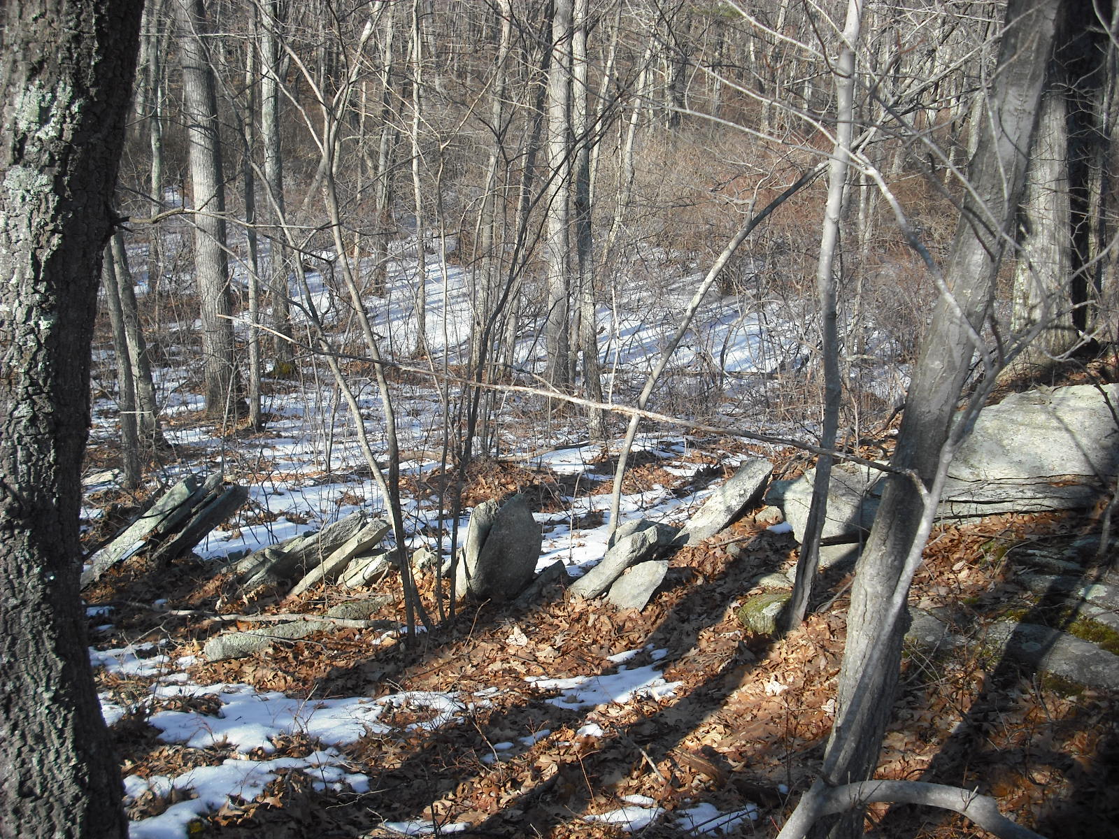
Note that the sizes of slabs in the same group are similar, suggesting that someone  was sorting these for wall construction. Close by is a partially constructed stone row.

This site also has a bird effigy.


It seems like a great deal of work and material would go into constructing a slanted slab wall.   Maybe this stone was used because it was easy to split, and  would break off naturally from the action of frost and ice. The only other place I have heard of having a wall like this is Gungywamp Swamp in Connecticut.  The preservation group that manages it describes their wall as a farm wall that was topped off with ropes. These stone rows may have first been constructed by natives, and later they were incorporated into farm walls, as described  here.
     The walls in this northern RI site run down steep hills, so this slanted slab arrangement may add stability. The slabs in the wall may also be set standing instead of laid flat so that water will run down instead of freezing between the slabs and disrupting the wall.  However, why would someone stand the single slabs up instead of leaving them flat on the ground?  This also seems like more work, but may prevent the  thin slabs from breaking under accumulated  ice.   For the natives who originally worked the stone, standing the slabs as manitous may have been a sign of respect.
     These standing slabs  are clustered near the outcrops they were chipped from. Some may have been moved a longer distance to stand alone as manitous.  Here one stands in a silent wood at twilight, along a trail traveled with snowshoes.  It is about 3800 feet from the site in the photos.

     And here is another one almost 2 miles away.
 If these manitous were chipped from the outcrops and moved considerable distances, they must have had some important function or great spiritual significance. This site could have been the source of  manitous even farther away.

Wednesday, January 2, 2013

Manitous in the Snow

Saturday afternoon I thought I'd visit one of my favorite sites two hours before the snow was predicted to start.  After 15 minutes of hiking, it started snowing heavily.  At this site, the rock projects from the ground in massive outcrops.  The rock is in thin layers that split easily, so the natives took advantage of this and left some ghostly manitous.
     Here is an outcrop with stone broken into slabs.

By this outcrop runs a stream where a  few small slabs have been left in a standing position.  This may be natural, but they seem to have be placed in a group.


Along a trail following the edge of  a cliff, there are some large manitous.  First a tall thin one,

then 560 feet later, a wide, broken one. Perhaps they marked the trail, or the edges of campsites.

At the end of the trail, a view of a group of manitous on the steep slope of a neighboring hill.

Here is a better picture taken a few years ago.
 This group consists of  at least five tall, thin slabs standing close together, and many small manitous standing directly in front and downhill of them. Here is a drawing I did a few years ago, to try and separate out the different slabs.

There are many manitous  at this northern RI site, and some stand in groups.  There are few or no manitous at other sites in this area where the stone does not break into thin slabs. There probably was no reason to move these small slabs more than 1500 feet from the outcrop they were broken from. If the manitous have some spiritual significance, it is linked to their site of origin.  Next time I will show a site with many of these grouped manitous.