Wednesday, May 16, 2012

Bandelier National Monument

Last week I took my annual vacation in New Mexico, stayed in Albuquerque, and visited several fascinating sites.  One was Bandelier National Monument, near Los Alamos.  There's plenty of information about it at www.nps.gov/band and some good downloadable publications at http://www.wnpa.org/bandfreepubs.asp. Also, Adolph Bandelier's books about Pueblo Indians are available in several e-book formats on www.gutenberg.org.  
     Pueblo Indians occupied the Frijole Creek valley up to 1550 AD, and then migrated to the Cochiti and San Ildefonso Pueblos.  The probable cause of migration was extended drought.  In this valley is Tyuonyi,  a large circular pueblo ruin with a kiva.  The walls had no doors, since entry to the rooms was through the roof.
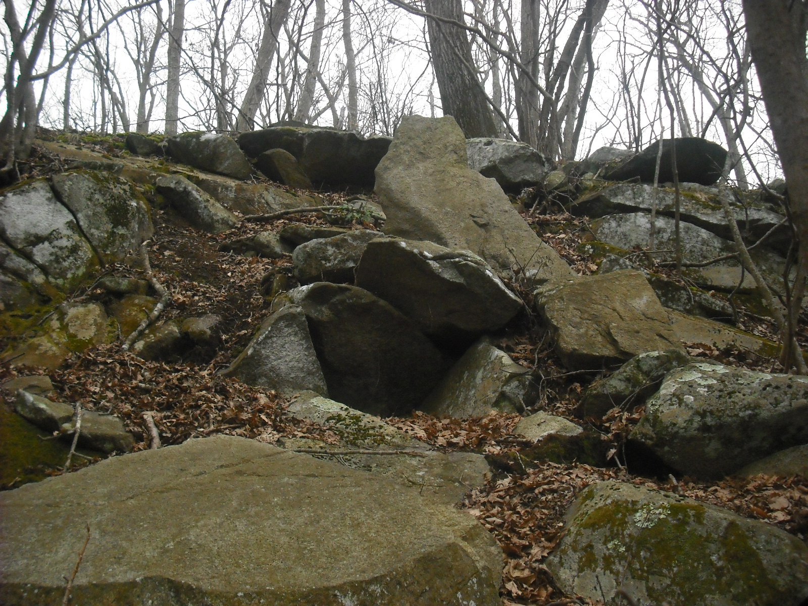
The nearby cliffs are of soft volcanic rock, and are riddled with small caveates that were dug out and used as dwellings.
 
Some of them may be entered using ladders.   Inside one caveate is a dome-shaped room about 6.5 feet high at the center and 10 feet in diameter.  The gouge marks are still visible in the smoke-stained ceiling.
Stone houses were built against long sections of the cliff, and the caveates were the back rooms. The small holes in the cliff wall held the logs that formed roofs and floors.
As I approached this cliff, I noticed three propped boulders along the trail.
One or two propped boulders might be a coincidence, but the ones in the above photo seem to be deliberately propped and facing southeast.  There are other stone structures along the trails.
     This is the famous Alcove House site, previously known as Ceremonial Cave.  It contains a reconstructed kiva, and the caveates and log holes from old dwellings.  Access is a 140-foot climb up four long ladders, definitely not for those afraid of heights.

At the mouth of the cave  are two squarish boulders facing directly west.

These definitely look like they were placed this way. I'll see if I can find anything about them in Bandelier's books.
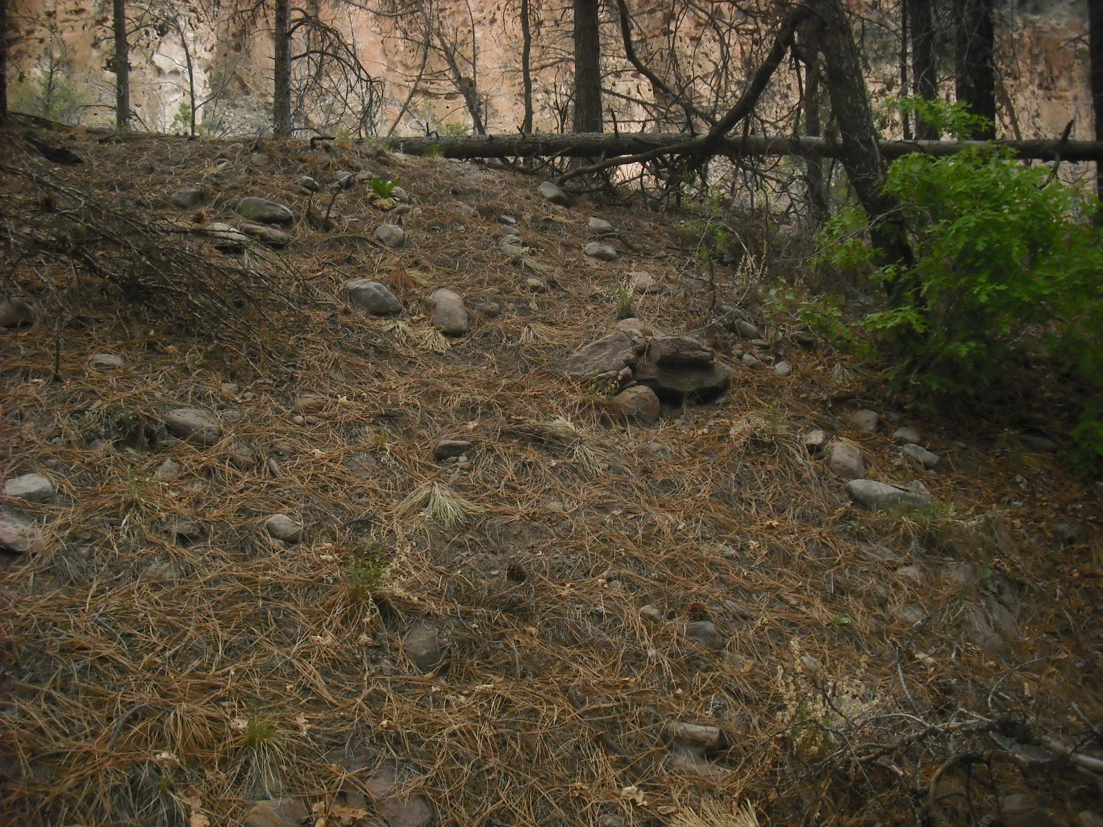
     On the way back, I spotted this bent tree about 300 feet from Alcove House.  The bend points towards Alcove House.  500 feet further is this slope with rocks and a possible cairn. These rocks are all about the same size and shape.
On top of this slope, 150 feet beyond the cairn, is this propped boulder with an oddly gouged surface.  The slope faces southwest over Frijoles Creek.

So, who propped these boulders?  I  don't imagine these have been standing since 1550, or they would have been buried over time or disturbed by excavations.  The  Pueblo Indians consider these ruins to be sacred, so maybe they placed them more recently.

Wednesday, May 9, 2012

King Philip's Seat

King Philip's  Seat is a hollow in the side of an outcrop, that is thought to have been used by Metacomet as a council meeting place.  The area, now Mount Hope in Bristol, RI,  was once Metacomet's summer encampment, Montaup.  I visited it in August 2008, on the last day the Haffenreffer Museum was open to the public.  Since then, the grounds are strictly private property.
    
The seat faces east.  The outcrop has some interesting features.
Directly in front of the outcrop is a small spring, reputed to be the site where Metacomet was slain. I don't think the PVC pipe was there then.
This site has a commanding view of Mount Hope Bay,  Tiverton, and Fall River.
Unfortunately, it was raining.
There was a wetu (wigwam) on the grounds.  This became a handy model for painting reconstructions.

Wednesday, May 2, 2012

The Face Rock

Somewhere in northern RI is this dirt road that passes overgrown farms along a lake.  This road was once the main road to Connecticut, but horses and coaches no longer pass by.
On the south side of the road is a wall extending into the lake.  Since the lake is dammed, the end of the wall is now underwater.  This wall has some very unusual features.
There are some platform cairns near the shore, where the wall enters the water.
Returning to the road, I notice an outcrop on the north side, with this perched boulder.
And here is the other side.
Tool marks are visible around the eye sockets. I doubt this is vandalism, since it would have been a lot of work, and would not have been visible from the road.  Besides, vandals usually use paint. As I mentioned in the last post, I suspect  Indians created some of these large effigies once they obtained metal tools.  The face is oriented to about 150 degrees, and is looking at this view.
There don't seem to be any other structures on or around this little hill.  So why is this face staring from an outcrop? 
On the map, the road is in black, the wall in blue, and the cairns represented by a red dot. The stone wall has a 73 degree bearing facing uphill, suggesting alignment with summer sunrise.   The face rock, in yellow,  is on a direct line (yellow dotted line) with this wall.  Perhaps it was a marker for summer solstice sunrise, and the face had some mythological significance.


Wednesday, April 25, 2012

Fort Barton

Fort Barton is a historic site on a steep hill in Tiverton, RI.  The hill's strategic location overlooking the narrowest crossing between Aquidneck Island and the mainland led to its use as a fort during the Revolutionary War.
Here is the view looking west towards Portsmouth, with the two piers remaining from the old Stone Bridge visible in the photo center.  Mount Hope Bridge is to the right  in the distance.  The earthworks from the old fort are still visible on the hill.
This area, with its strategic location, was previously the site of a Pocasset Wampanoag village. Traces of Indian use remain in the surrounding woodland.
A long stone row runs along the crest of the hill, down its steep side, crosses a boulder, and disappears into the woods.
On the side of a rocky outcrop stands this strange slab.  The shape and two horns suggest an owl.  Perhaps its significance is that it is standing over an opening in the side of the outcrop. The opening is only about a foot deep.
I first saw this effigy two years ago, when late afternoon sun illuminated it. 
Sin and Flesh Brook runs through this woodland.  The name comes from an old story that four Indians killed a Quaker man and  chopped up his body with tomahawks, and threw the pieces into the brook. Near the brook is this striking effigy of a turtle.
It is about eight feet long, and has some shell details worked in. At lower left in the photo is a pile of loose rock, presumably  fragments carved from the effigy. I suspect that this and other large effigies, such as the standing bird (11/23/11), and a face-rock I'll show at a later time, were carved after the Indians obtained metal tools. Like the standing bird, this turtle is in an area with quarrying.

Wednesday, April 18, 2012

Little Compton, RI

Manitou (p. 113) mentions two sites with historical significance in Little Compton, RI.  One is the cemetery at the Congregational church, which has the tombs of Benjamin Church and family.   The other is Wilbour Woods, the site of Awashonk's village.   On a sunny day, I visited these places. Below is the Congregational Church, with its cemetery crowded with very old and well-carved tombstones. In the center photo, and close to the church, are the Church family tombs, with two smaller ones for infants.
The closest double tomb is that of Benjamin Church. Mavor and Dix overlooked two other table tombs in the cemetery. One is dilapidated, and the other is the double tomb of  Captain William Southworth and his wife Rebekah . This tomb also has typical 1700s stylized angel faces.
This type of tomb is uncommon in New England, but may be derived from tombs of English aristocracy, that were often topped with a recumbent effigy of the decreased.  Mavor and Dix may be trying to make too much of a connection between the Church family tombs and the table rocks at Awashonk's village
     Wilbour Woods is the Little Compton town park that was site of Awashonk's Sagkonate winter village.
There a stream winds past an old stone row.
                                              Mavor and Dix mention toppled table rocks at Wilbour Woods.  There are a few slabs that may once have been table rocks, including the one below,


and this one, which was propped up again on blocks.
     Beside the road stands this massive slab about 7 feet tall.  There is no inscription, but it was probably set up in modern times as a memorial.  Awashonks and some  tribe members are supposed to be buried at Wilbour Woods, but the location is not marked.
Or is it?

Wednesday, April 11, 2012

Falling River

Fall River, MA, took its name from the Quequechan or "Falling River" of the Pocasset Wampanoags. I have often wondered how Fall River looked centuries ago. This 1812 map of Fall River  shows the Quequechan river flowing  from Watuppa Pond to a small pond, and then falling nearly straight down the steep slope to a pond at present-day Battleship Cove.   The map shows that the area with Long Pond (now Firestone Pond) has a massive boulder and some partially submerged boulders named the Peaked Rocks.  Unfortunately, these are long gone.
     Philip's History of Fall River describes the pond at the brink of the falls. On the south shore of the pond was a huge conglomeration of boulders known as Cleft Rock, which extended to present-day Bedford Street.  A narrow path went  about Cleft Rock, and Main Street passed through the cleft.  Here is my imagining of the falls, looking east to the hill on County street where Rolling Rock still stands. Lookout Rock at Weetamoo Woods was the model for Cleft Rock.


     The Quequechan river powered the mills of Fall River through the 1800s.  A dam was built across the falls, and then raised two feet in 1826.  This flooded the river and Watuppa Pond, but afforded consistent water power for the mills. The last water-powered mill burned down in 1974.
     This photo was taken by my father in the early 1960s.  It shows the  Quequechan river flowing from under some mill buildings on Second street near the post office.  Even though I was very young at the time, I still remember how bad the heavily contaminated river water smelled.
Here is the pipe the river was entombed in. The Academy building is to the left, and the post office to the right.  Notice the lack of fencing and barriers around the construction.  Evidently, nobody was worried about personal injury lawsuits.
 I have often wondered what the Falling River looked like before it was used to run mills, and then buried in a culvert.  Here is my interpretation.
The first falls and Cleft Rock would not be visible from this angle. The river fell over a series of eight falls before reaching the Taunton River. Peaked Rocks and the massive boulder are in the foreground.
Here is the view from a ledge beside one of the falls, looking toward the sun setting over Mount Hope in winter.

Wednesday, April 4, 2012

Stone Carvings at Miantonomi's Cave

As I mentioned in a previous post, some of the boulders at Miantonomi's Cave have round pits that look man-made.  Here are the prominent ones on the top face of the square boulder.
I was wondering if sticks placed in the holes could have been used as sights for astronomical observations.  Unfortunately, the bearings along the lined-up holes don't correspond to any events.  Maybe the holes were created by native  techniques when the boulder was squared off.  Here is a small slab with two of these holes, about 10 inches apart, resting on the ground directly west of the structure. Presumably this was left over from the process.  I once heard or read somewhere that very old gravestones in a Narragansett cemetery had two holes.  Maybe the gravestones were produced by this type of stone work.
A boulder on the east side of the structure has a large carving of a triangle.  The base is 19 inches wide. The lines are about 2 inches deep, so carving this required a lot of time and energy.  Perhaps the triangle symbolizes a sacred space.
I have seen large triangles in other sites, such as the structure in the 9/3/11 post, which has a huge manitou standing behind it.    On the west side of the structure's base is this odd shape, which from this angle looks like an arrowhead pointing up inside a recessed square area.
The edges of the surrounding square shape look like it was gouged out of the rock.  From this angle, the center form looks  like a carving of a bird. Some genius spray-painted the square black a long time ago.
Here is the structure from the west, with the mark to the right.  It  probably was carefully built as an observatory, and  had great spiritual significance. Maybe someone remembers.