On the east shore of South Watuppa Pond is another possible Indian summer camp site, a long stone row with a round enclosure. This site is dominated by a huge boulder with a shape suggesting a turtle.
The other side of the boulder is completely flat, as if it had been split away. The horizontal streaks on the boulder are caused by algae and sediment drying to the boulder after being deposited at different pond levels.
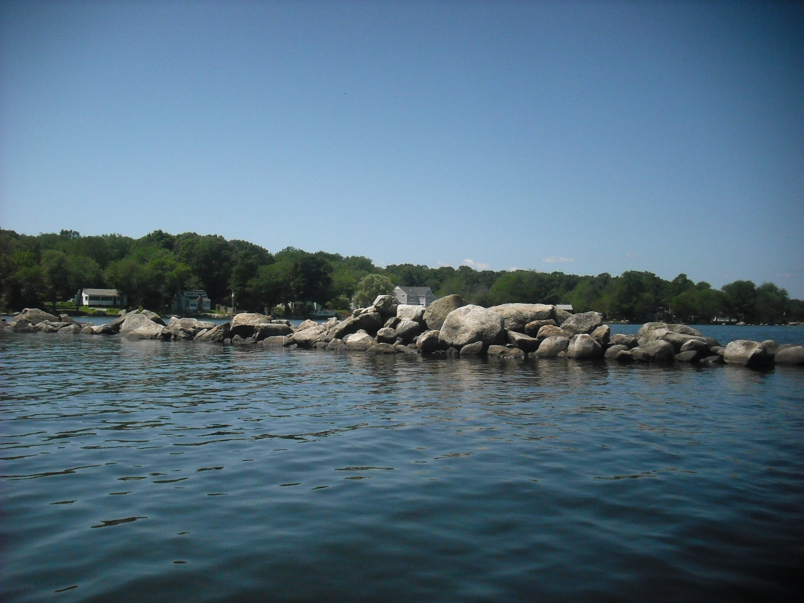
This site is enclosed by a 70 foot long stone row of carefully stacked rocks. Note that there are larger rocks on top of smaller ones, a feature not seen in the wharves constructed for camps and cottages. A large puddingstone is seen to the right in the photo below.
On the shore are some more large stones in a loose row that runs parallel to the shoreline. Some of these stones resemble manitous. This may have been the back wall of the camp site. This section of shoreline was once a beach for the local YMCA camp, and was not developed.
The area enclosed by this stone row is shallow, sandy, and free of large rocks. Directly west of this row is a circular enclosure about 60 feet in diameter..
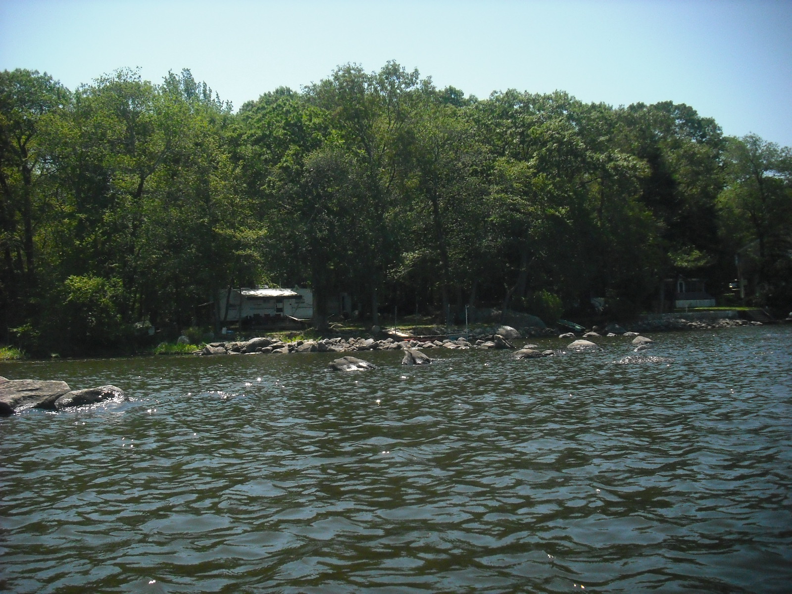
A brook enters at the space immediately to the left of the camper. Although this could have been a garden, this enclosure differs from the ones on the west shore in that the rocks are much larger, and some have a jagged, pointed appearance. Satellite imagery shows the layout of this site.
There appears to be a large boulder upstream on the brook, in the lower right part of the photo. Before the pond level was raised, most of the stone row and the round enclosure would have been out of the water. Here is a map of South Watuppa Pond, to which I have added the water levels.
The outer edge of the red area is 5 feet, and the inner edge is 10 feet. The pond level is usually higher in winter and spring, and the water "goes out" during the summer and fall. The Troy Dam was raised two feet to keep water running the mills during the summer. If the pond level was raised at least two feet, the original shoreline was somewhere near the 5 foot mark. The structures in this and the 6/13 post would have probably been out of the water, but still close to the water's edge. There is a large shallow area at the north end of the east shore, with some very interesting structures that I will post later.
Here is how the east shore site may have looked on a sunny summer afternoon a few hundred years ago.
Since I don't know the purpose of the enclosure, I have left the sand bare. Upstream on the brook is a propped boulder, and there are wigwams to the left behind the stone row, and fields further on.
Most of these photographs were taken in 2010 and 2011, and some were shown on Larry Harrop's blog. Unfortunately, due to all the rain, the water is just not going out this summer.


Thank you for taking the time to create these posts, they are very interesting and I had never taken a look at Watuppa Pond beyond probably 99.99% of people have, meaning from Route 24 at 60 ... (or in 90% of the time, 85 - good thing the police just announced they'll be out looking for that).
ReplyDeleteAfter seeing your posts tonight I started looking at the ponds with Google Earth, and wow, so many stone rows, some seeming to follow the shoreline, some as you mentioned in more geometric shapes. It really does spark the imagination and I have to start finding out more. I hadn't realized that kayaking was allowed, so maybe sometime I'll be able to see them from a lower altitude than Google Earth.
Also, thanks for the photos of Wilboer Woods, that's a definite on my list now, being a Wilbur myself.
This is a great article. I love our New England history. Thank you for taking the time to do all this. More people should know the rich history of this area because it is so fascinating.
ReplyDelete