Fort Barton is a historic site on a steep hill in Tiverton, RI. The hill's strategic location overlooking the narrowest crossing between Aquidneck Island and the mainland led to its use as a fort during the Revolutionary War.
Here is the view looking west towards Portsmouth, with the two piers remaining from the old Stone Bridge visible in the photo center. Mount Hope Bridge is to the right in the distance. The earthworks from the old fort are still visible on the hill.
This area, with its strategic location, was previously the site of a Pocasset Wampanoag village. Traces of Indian use remain in the surrounding woodland.
A long stone row runs along the crest of the hill, down its steep side, crosses a boulder, and disappears into the woods.
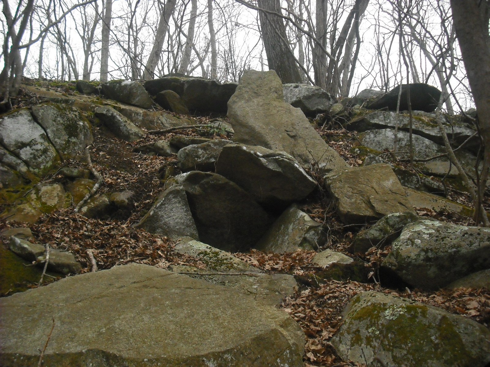
On the side of a rocky outcrop stands this strange slab. The shape and two horns suggest an owl. Perhaps its significance is that it is standing over an opening in the side of the outcrop. The opening is only about a foot deep.
I first saw this effigy two years ago, when late afternoon sun illuminated it.
Sin and Flesh Brook runs through this woodland. The name comes from an old story that four Indians killed a Quaker man and chopped up his body with tomahawks, and threw the pieces into the brook. Near the brook is this striking effigy of a turtle.
It is about eight feet long, and has some shell details worked in. At lower left in the photo is a pile of loose rock, presumably fragments carved from the effigy. I suspect that this and other large effigies, such as the standing bird (11/23/11), and a face-rock I'll show at a later time, were carved after the Indians obtained metal tools. Like the standing bird, this turtle is in an area with quarrying.


No comments:
Post a Comment