Wednesday, August 29, 2012

South Watuppa Pond Grinding Slicks

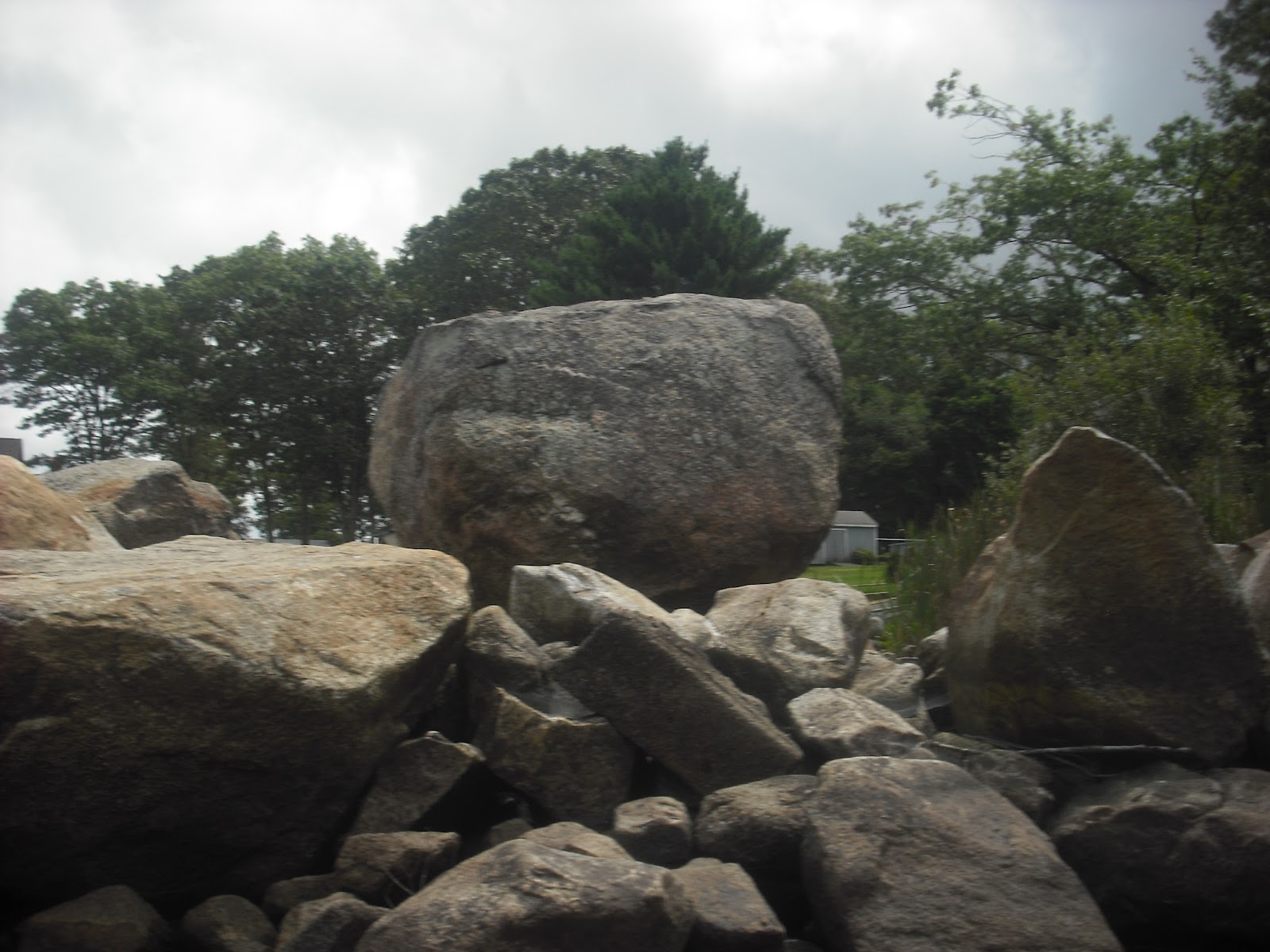
In the past two months, I have shown several stone row sites along the shoreline of South Watuppa Pond.  The stone rows have propped boulders, manitous, and effigies, suggesting they were constructed by Indians.  Some of them may have been campsites, and some have smaller features suggesting their uses.
Here is one site on the Fall River shoreline, south of the state boat ramp (Dave's Beach).
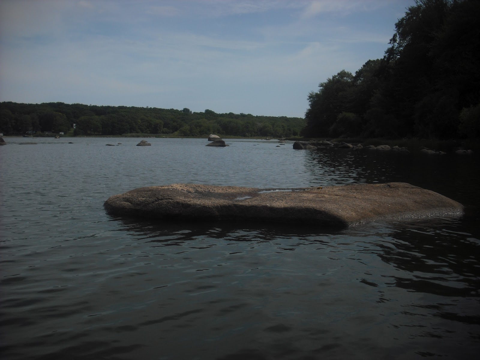
This stone row projects north from a small peninsula, and forms a small enclosure. Here is the  propped boulder at  the end of the wall.
Inside the enclosure is this large  rock with a  smooth, slightly concave top surface. The water inside the enclosure is less than a foot deep, so it would have been dry land before  the pond was raised in 1826.
  Similarly, next to the turtle effigy boulder (7/11/2012) further south along the shoreline is this rock with a squarish depression.
These may have been grinding slicks that were used for grinding acorns or edging tools.  These are shallow and irregular, in contrast to the round and deep mortars used for corn.  It is interesting that this one is close to an effigy, suggesting a ceremonial use.
     Here is a large flat boulder with two depressions at Cranberry Neck. The water around it is only two feet deep, so it would have been out of the water before 1826. The rocks in the background are part of the stone row that extends to the rocky little island (7/18/2012).
The smooth, concave surface  of the smaller depression suggests grinding.   Those are freshwater clam shells in the larger depression.  This is now a lunch spot for muskrats and mink.
     Here is another possible grinding slick, from along the east shore.  Notice that there appears to be a "gutter" to the left in the stone, similar to the large stone shown 9/23/2011. There aren't any other structures close to it, but the area was farmed and then developed for camps and cottages.
     Finally, here is a large flat stone near the west shore stone row shown 6/13/2012. The water is less than a foot deep here.
From this angle, it does resemble a turtle.  However, inspection of the top from the other side shows this 6 inch deep depression, also with a "gutter".  If this was used as a grinding slick, a basket or bucket could have been placed against the gutter, and material pushed into it, instead of scooped out of the depression. These gutters are to the left of the depression, suitable for right-handed use. It is interesting that what might have been a turtle effigy also had a practical use.
Of course, depressions on the tops of otherwise flat rocks could be natural.  However, these are noticeably concave  and are near camp sites. Their proximity to the shoreline would have made them useful for grinding acorns, since the acorn meal had to be soaked in water to remove the tannins before use. 


Wednesday, August 22, 2012

Stone Rows of South Watuppa Pond: Fall River Shoreline

Two weeks ago,  I visited the shoreline of South Watuppa Pond from just north of the state boat ramp (Dave's Beach) to the turtle boulder shown previously (7/11/2012).  Even though I thought I had seen nearly everything, there were still some very impressive structures to be seen. Since it was cloudy and windy, I took some pictures, and came back last Friday, when it was sunny and calm.
     Here are two parallel stone rows about  15 feet apart, forming an enclosure filled with loose stones. These are in shallow water, and would have been on dry land before the pond level was raised in 1826.
Here are some details from the first stone row.
 Large stones are placed on top of smaller ones.

Between the two stone rows is this enclosure, with a large stone resembling a manitou in the center. There is a small puddingstone  to the right of the manitou.
The second wall has two large propped boulders.  Daylight is visible under both. Some of the stones resemble manitous.

The large boulder at the end of this stone row looks a little like a bird facing to the left. Farmers clearing fields and contractors bulldozing areas never organize boulders this way. Here is a closer look at the large rounded boulder, with a manitou to the right.
And here's the other boulder, with a manitou to the left.  This looks like an effigy, perhaps of a fish.
     The large manitou between the two stone rows faces  northeast, apparently to Rolling Rock in Fall River.  This has to the the most elaborate structure on South Watuppa Pond.


Wednesday, August 15, 2012

Summer Solstice Revised

This is why it always pays to take lots of photos, and review them later.  Here is a photo I took at Miantonomi's Cave on summer solstice at 7:26 PM. The cave was dark at 7:37, and  sunset was at 8:22.  I was expecting to see some solstice indicator closer to sunset.  Evidently, the final light pattern occurs about 55 minutes before sunset on summer solstice.
                                   
 This may be due to the structure of the site, since the windows are behind a boulder on a wide platform.  As the sun sets, the edges of the platform and boulder cut off light to the windows. This photo was taken at 7:20 PM on summer solstice.
The top of the platform is about 8 feet above ground level, and this structure is partway up a hill. The boulder with the slanted edge is on top, and the cave roof is barely visible behind the boulder.
Here are the two windows.  The notch is visible in the bottom of the large window, but the small window is barely visible. Below is the  large window, photographed August 13, showing light coming in through the notch. The bearing of the notch is about 305 degrees, so it may be designed to create a sun dagger on August 13.
The light that forms the small dagger to the right on the cave wall comes through this small window, with the large slanted  boulder visible outside.
When I look more closely at the summer solstice photo, I see three slanted lines on the cave wall.  The small sun dagger to the right is at the top of a faint diagonal line, presumably the one for summer solstice. The center line is the one the sun dagger followed on Monday, August 13th.   I am not sure of the significance of the line to the left. I also notice that the edge of the sunlit area to the left touches the tops of the dimples on the wall.


 The angles of these lines look similar to that of the slanted edge of the boulder.  Apparently, as the sun sets further to the south, the sun dagger moves further to the left on the cave wall. The patterns of light admitted by the  two windows and altered by the projecting stone determine the astronomical reading.  It will be interesting to see the patterns of light at equinox and winter solstice.

Monday, August 13, 2012

August 13 at Miantonomi's Cave

I just returned from watching an amazing show at Miantonomi's Cave this afternoon, on the date of the  Native American Green Corn Festival.  This show was performed by moving  sun daggers, and I will display the highlights. 
The last entry about this site was Summer solstice.  The cave was full of light at 7:26 and dark at 7:36.  However, the wall behind the large boulder was in sunlight almost until sunset, so I assumed this was the correct solstice marker.  This evening, the 318 degree bearing of the boulder blocked out most of the sun, leaving a small patch visible at 7:16.
Inside the cave, a dance of three sun daggers was in motion.  Here it is at 6:44
The streak of light on the boulder to the far left is coming in through the notch in the bottom of the window. The light makes a larger dagger on the wall below the projecting rock, which touches the center dimple on the wall.  Meanwhile, light from the other window forms a dagger that travels up the wall as the sun sets, with its point touching the large  crack in the wall. The central dagger seems to break up, leaving a spot touching the central dimple. The whole dagger then vanished.  Due to the trees around the site, it is hard to be certain if this was supposed to happen.
At 6:51, the dagger reappeared and entered the area with the dimples. It seems to be a continuation of the ray through the notch in the window base.  Note that the dagger to the right is still  touching the crack, but is higher on the wall.
     7:02 PM
7:07 PM
A tiny dagger crosses the "nose" of the projecting rock in the cave, while the center of the original, center dagger dims, leaving a bright spot to the right at 7:08.
 This vanishes in seconds.
The dagger reappears at 7:11.
It creates this pattern at 7:16
A bright dagger cuts across the projection, and a tiny, bright spot appears again. And then the cave slowly goes dim by 7:20.
It is hard to be certain if this is what the cave's builders saw, since the site is now surrounded by trees, and the sun sets behind a forested hill.  However,  since the  points of the daggers touch dimples, a crack, and a large  projection from the wall,  this site is probably a sophisticated astronomical observatory. It will be very interesting to see the light change in this structure at equinox and winter solstice.


Wednesday, August 8, 2012

Hemingway Bluff

The Sunday afternoon kayak outing was canceled due to strong winds.  This week I'll show some interesting pictures from 2010, at Hemingway Bluff in  Joshua Tree National Park.  This is a very popular site with rock climbers.
There's two climbers looking over the edge, and one ascending in a huge crack. I don't know how they do it.  In front of the bluff is a pile of  huge boulders.
I started looking into the little shelters at the base of the boulders, and saw flat slabs.

 These could have been work surfaces.  The biggest surprise was these big flakes of rock under the edge of the large boulder to the left.  These were held in a standing position by other rocks.  One would expect these flakes to be lying flat, like the large ones, instead of standing up, if this was only a natural process.

These resemble manitous.  Who knows how long they  have been standing in this protected area under a boulder, and what their purpose was?  Outside the boulder complex, some more familiar sights.


Wednesday, August 1, 2012

A Large Enclosure

Last weekend's kayak outing was rained out.  Since the Thunderbird Nest enclosure was mentioned on  the Rockpiles blog, I think I'll show my photos of a large enclosure.  These were taken in May of last year, somewhere in MA near the site of a praying Indian village.
     I was walking along an old road on a Saturday afternoon.  This road was abandoned after a major highway was built nearby  in the 1950s, and it is amazing how  the forest reclaims vacant areas.  Once school kids crossed here.
As I was walking, I looked uphill and saw the following.  Large rocks litter the slope, and at  the top  stands a low "wall" of smaller stones.
The view looking downhill from the top of the slope.
The center of the pile has a large cavity.
Here's another view. The enclosure is about  eight feet across, and is visible at the top of the rocky slope in satellite imagery. That looks like a propped boulder directly  uphill, near the top of the frame.
  So what is this?  The size and shape are similar to that of the Thunderbird Nest, so maybe this was a place for vision quests.  Ot it could be a sweat lodge base, or a fort built by kids from the nearby school.  I hope  when I go back in the fall, I'll find more structures and get a better idea.