Wednesday, April 24, 2013

Boulders on a Hill

Monday was a lovely spring afternoon to go for a walk through a marshy area.  The plants sprout and bloom here first, emphasizing how productive swamps are. This area is marked as a farm on a map from the 1880s, and there was a small sawmill  further up this stream.  Now the forest is reclaiming the land.

On the side of the  steep hill overlooking the swamp,  a rocky slope faces southwest.  Near the bottom stands this propped boulder.  The boulder and base have different textures and colors, indicating they weren't broken from one large boulder.

Note how neatly the boulder fits on the base at the points of contact.  The lower edges of the boulder look like they were chipped away to create this effect.
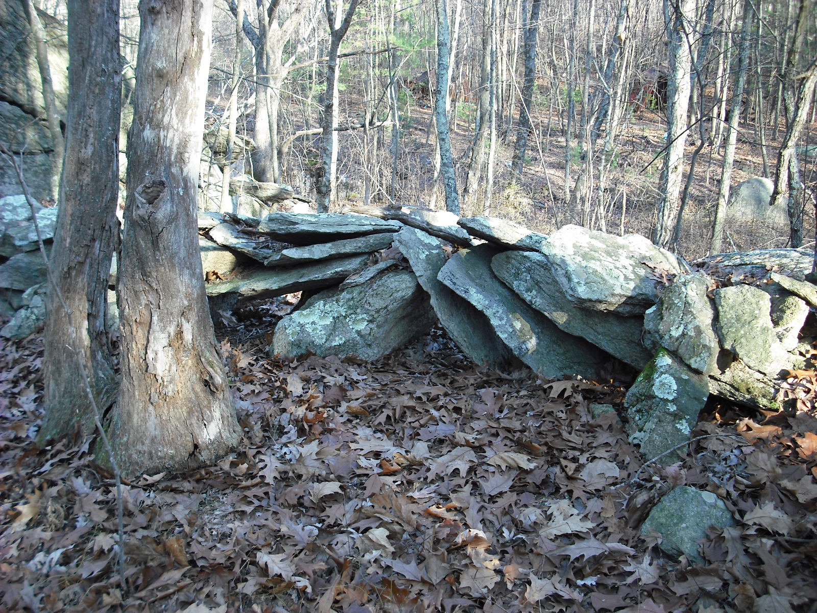
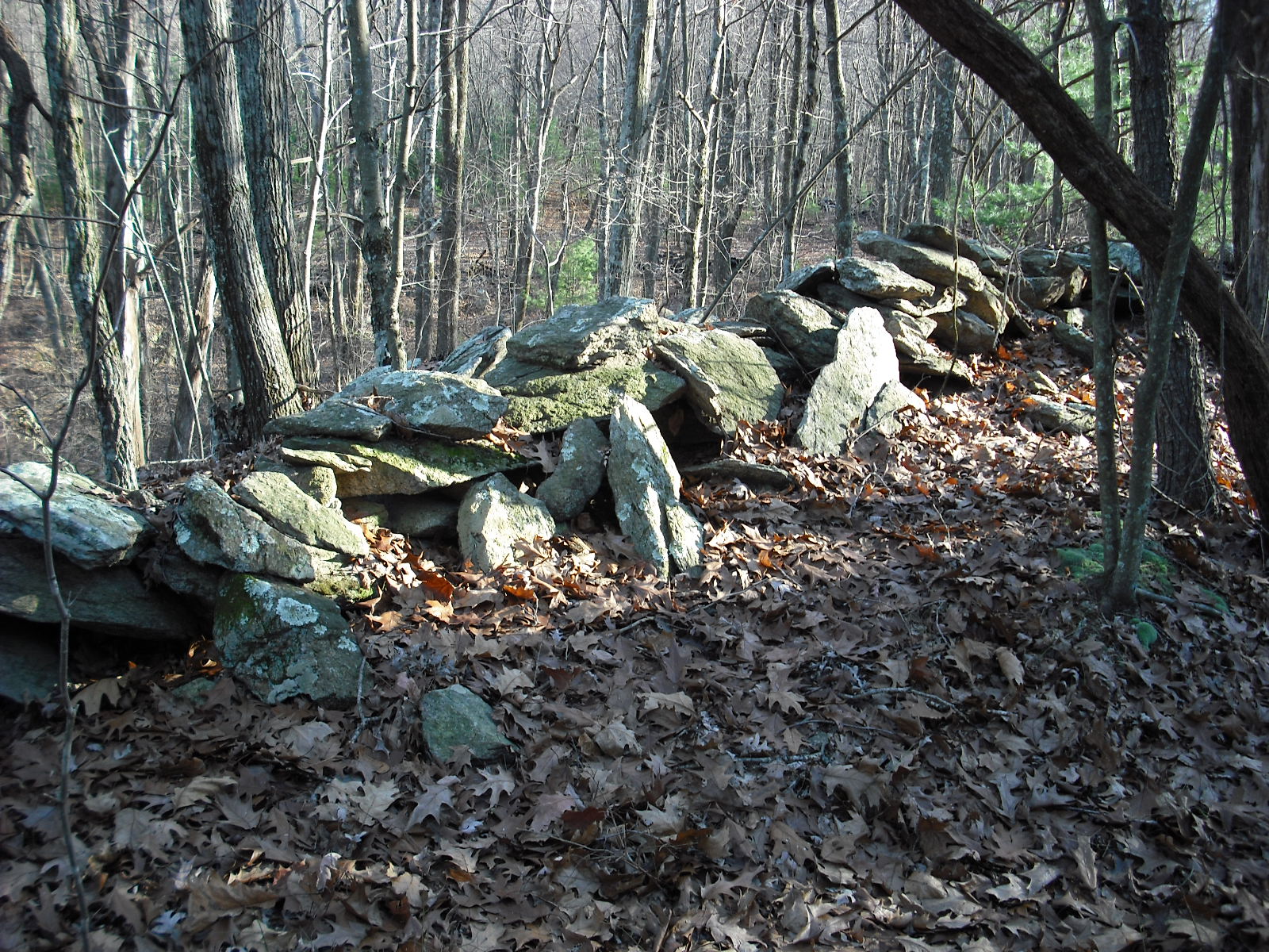
     At the top of the slope, this massive pile of rocks is neatly stacked on top of a couple of boulders.
The rocks are similar in size, and have flat faces.   A small slab resembling a manitou is standing in the middle of the pile.  Someone may have placed it there to keep it from getting broken.  Although this pile could have started as a donation pile, its later purpose is suggested by its location at  the end of a long farm wall.
My guess is that the rocks were broken up from larger stones and  stored here for use in further wall building.  A farmer, or Natives working for a farmer, broke up these rocks from boulders at the top of the hill and stacked them here. Following the wall, I see this impressive propped boulder.
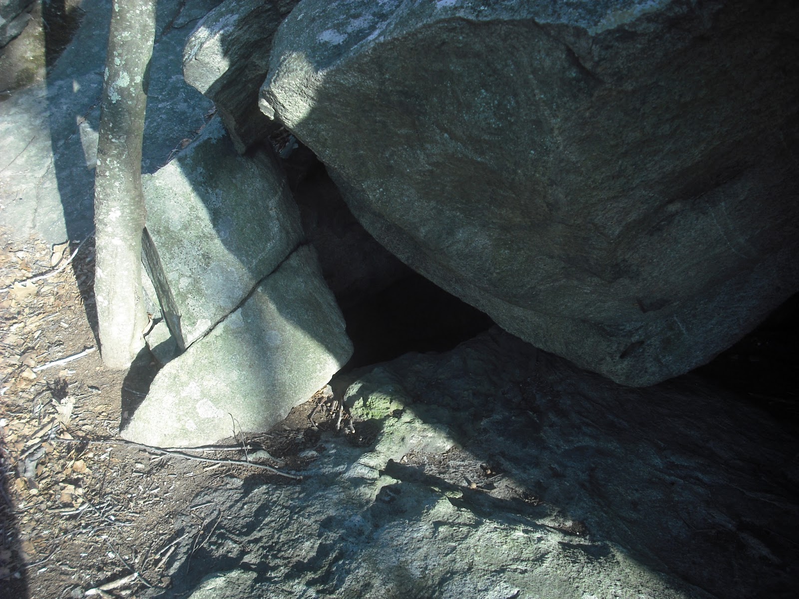
It looks like it is in danger of tumbling down the hill.  Note the sharp edges on the planes  facing the camera.  It  looks like pieces were broken off.
Here is the front view.  There is a large concavity to the right in the boulder, suggesting some deliberate alteration.  Many of the propped boulders I have seen look like stone was chipped away  to create  the typical smooth, oblong shape. The boulder is a light, smooth stone, while the base is foliated granite.  This is probably a glacial erratic, dropped here by a glacier 17,000 or more years ago.  Glacial erratics such as Hipses Rock often had some significance to the Native Americans, at least as landmarks and meeting points.  In front of it, a small piece of quartz, and then a large chunk of quartz.

And finally, on the trail back to the marsh, a nearly buried piece of quartz next to the stick, and a young bent tree.

The first two pieces of quartz have not been sitting here long, since they are on top of the ground.  This area was farmed in the 1800s, then abandoned to the forest.  The propped boulders suggest Native use, and the piled rocks and walls, farm use.  The quartz and  bent trees suggest Native remembrance.


Wednesday, April 17, 2013

Modification of Another Native Stone Row

       Here is another unusual stone row from the same area as a previous post (3/27/13).   This segment extends between two large outcrops. Its unusual structure suggests it was built by natives.
 
 Manitou-like stones stand against this wall.   I often thought these were placed to hold the stones in place.

However, a small space is  visible between the manitous and the other stones of the row.  These would not have served to hold the stones back. One possibility is that a farmer utilized this stone row by placing  these stones to hold fence posts.
This wall is uphill from an old farm road, in an area with building foundations. Here I have imagined it as a meadow fence with barbed wire.
Once I started looking, I noticed this detail in other old photos.

Of course, this modification would appear at walls used to keep in livestock.


.

Wednesday, April 10, 2013

Strangest Propped Boulder Yet

.
Somewhere in Northern RI, a stream is dammed to form a small pond.

The water flows out of a small opening in the wall.  There are no building foundations, so it does not look like there was a mill here.

Further upstream, and leaning against an outcrop, is a very strange propped boulder.  One end is nearly square, and about 2 feet on each side.

This side view shows it has its own bent tree, and a strange shape, like an  old TV picture tube. Usually propped boulders are oblong with smooth contours.
Also, the other propped boulders in this area are on top of hills, not in a low area near a stream.
     This shape does not look natural, so  it may have been quarried from a larger boulder at this outcrop. Note that the supporting stone is pointed, and has very little contact with the propped boulder.  Usually  supporting stones are rounded or square.  The pointed supporting stone could have been used to allow greater access to the lower part of the boulder for carving, or for some ceremonial use.  Whether this shape was intentional, or if this was a work in progress, is a mystery.


Wednesday, April 3, 2013

Vernal Equinox (Almost) at Miantonomi's Cave

I have visited this cave many times and photographed sunlight forming daggers and other patterns on the cave wall.  While I have seen some distinctive patterns on August 13 and autumn equinox, the light  is diffused by the surrounding trees. At vernal equinox, the pattern would be the same as that at autumn equinox, but clearer due to bare trees. That said, it is hard to get vernal equinox pictures, since lately the weather has been cloudy, rainy, or even snowy.
       Last weekend the weather was clear, so I took  photos in the cave.  The first pattern happens around 5:43, when a thin line of light enters through the notch at the bottom left of the larger window.
Here is the thin line of light appearing inside the cave.
By 5:51 this light spread to a large triangle,
that by 5:58 spread further along the wall.
The light continued spreading, and formed the final pattern by 6:33 PM, with a point that extends to a faint mark on the wall beneath the projecting stone.
Here the mark appears  near the center of a photo taken 9/21/2012.  
     The mark looks like \ /, which could be an inverted triangle.  I have seen an inverted triangle carved into a boulder at another site with alignments (1/23/13 ).
The problem with taking photos is that I may be missing a pattern and  introducing my own shadow.  This time I tried  time-lapse photography.  I  placed the camera on the ledge on the western wall of the cave, set to take 1 frame/second with a playback of 30 frames/second.  This condensed  about 50 minutes into almost 2 minutes. The video is at Youtube here.  
      Since the camera is looking at bright spots, they appear a little burned out.  However, it is easy to see how   the point of sunlight moves across the cave wall and touches the mark at 6:39.  Since this is 10 days after equinox, the point may extend slightly beyond the mark. 
     The sun will set in the same position for August 13 at the end of April.  Maybe time-lapse will reveal more patterns at Miantonomi's Cave.
     

Wednesday, March 27, 2013

Modification of Native Stone Rows

     Recently I went on a walk on the dirt road though an old farm  in a state park.  The first sight after an open  field is this old barn foundation. These were often built into hill sides, with only one exposed foundation wall.

 
The other side has a jumble of stones, which was probably the side wall
Just beyond this barn foundation is a  row of slanted slabs, some with V-notches.  This is the same row found by Larry Harrop.
     The stones are about three feet tall, two feet wide, and 6 inches thick.  Assuming granite weighs 150 lbs per cubic foot and the buried part of the slab is one foot long, the weight would be 600 lbs. Evidently, moving these slabs anywhere would require great work.
     Close by is this outcrop.  The face shows layers that are equivalent to the thickness of the slabs, so the slabs were probably broken from it. This stone row design is so unusual, it is probably safe to conclude it was built by Native Americans.
  Here is a clearer photo of the stone row, taken five years ago.
     Some of these stones have notches at the top, such as the one near the center in the photo. 
     Further along, the stone row changes to a low wall and finally ends in a low area.  The total length is about 400 feet.
.
 To the west  is a second wall about 600 feet long, containing some more  standing slabs with notches.


This one has  a clear cut notch.
     These walls surround an area that was once a  meadow.  Here is the map, with the barn foundation marked at lower left,  along with  the first and second standing stone rows as dark blue lines A and B, respectively. Gaps in the walls may have been filled in with wooden fences, or  piled stumps.

     The standing stone rows were  built by natives, and a farmer added to them to make a meadow wall.  The barn was built there to take advantage of the stone rows. Although many stone walls look too low to have contained cattle and sheep, they originally had wooden railings for this purpose.  Fencing laws from the 18th and 19th centuries required walls to be at least 4 feet high, and this was enforced by the town fence viewer, who had the power to levy fines.  The notches in the stone slabs could have been added by the farmer to hold the railings in place.  
     Here is one possibility for adding railings.
 

.


Sunday, March 24, 2013

Hale Reservation 2003

Taken at Hale Reservation in April 2003
That sure looks like a manitou standing in the stream pouring from the  Storrow Pond dam.

Wednesday, March 20, 2013

Winter Solstice, Lunar Standstill

Here I am, out for a walk in the area containing the winter solstice marker in the previous post (3/13/2013).
 This boulder is about 7 feet tall, and propped on rocks shaped to hold it in place.
Nearby is a lower boulder with a rock on top.
Heading along the trail that runs past this boulder, I see a promising sight:
This looks like a trail marker, and to me it says, "Look here".  A short distance, and I find a rusty bucket, all by itself.
Even better.  A few more steps reveal the following, surrounding a bare patch of bedrock about 10 feet across.
This oddly shaped boulder suggests a bird profile (red lines) or a human face (yellow lines).  Or maybe it is supposed to be both, similar to Indian artwork from the Pacific Northwest.
This small site is about 480 feet from the propped boulder, and at a 245 degree bearing.   The site is at waypoint  1738, and the winter solstice boulder is at 1680.  The red dot 1733 is the boulder topped with a large rock.
The 245 degree bearing from the site to the marker  suggests lunar standstill.  The U-shaped arrangement of four rocks faces the marker, and may provide a vantage point for observing alignments. Or maybe it's all a coincidence.  In any case, it was the inspiration for this rather wild painting.
Who has visited this site, and why?