Wednesday, December 26, 2012

49 Palms Oasis

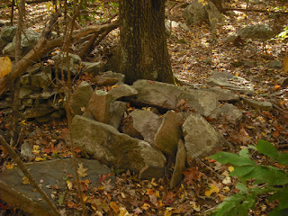
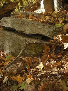
Since Friday's Winter Solstice outing was rained out, I'll show some pictures from Joshua Tree National Park. 49 Palms Oasis is on the north side of the park, close to the town of 29 Palms. This is a beautiful hike with many interesting structures. I took these photos in May 2010.  Here's the landscape looking back towards the town of  29 Palms.
Although this landscape is a jumble of rocks, some propped or perched boulders are evident.
Here, surrounded by blooming brittlebush, is the only stone row I saw at Joshua Tree.  It goes past three large boulders.

Continuing on, I see more structures, particularly propped boulders.
Finally, the oasis.
Under this boulder are many smaller rocks.   The grass was probably left by some nesting animal.
The oasis water is inviting on a hot day.
Outside the oasis, a large split boulder.  These are rare here.  The Cahuilla did not have access to metal tools until 1840, and by 1850 were on reservations. They did not camp at the oases, because the California palms are very flammable.
I have always noted that structures are along trails.  Presumably, the park trails were adapted from the old Indian trails, since they go somewhere important, usually to water. This landscape contains perched and propped boulders and effigies, but very few split boulders or stone rows.  I think the Indians created propped and perched boulders for their own purposes, and before the arrival of settlers.  Many of the stone rows, split boulders and cairns we see in New England were created by field clearing, boulder quarrying and wall building after the arrival of settlers.
     On the way back to the parking lot, I notice many stones tossed on top of a large rock. This rock is too tall for the stones to have rolled or bounced up there.  The lower rocks don't have these small stones on them, either.  These may be donations, or mementos tossed there by hikers.


Wednesday, December 19, 2012

Winter Solstice (Almost) at Miantonomi's Cave

This week's weather prediction was not very encouraging, so late last week I returned to Miantonomi's Cave.
 The slanted boulder on top of the structure blocked the sunlight from the cave's two windows, so there were no sun daggers such as those seen on equinox and August 13. The cave was dark the entire time.
If there were any significant patterns at the cave entrance, I couldn't tell, due to vandalism and shadows from trees.
I returned to the cave roof, where there is a prominent triangle carved into the stone.  I have often suspected  that this large triangle is part of a "user's manual" for this observatory.  The triangle does seem to point roughly in the direction of winter solstice sunset.
Note that there is also a small notch in the slanted boulder at the top of the structure, to the upper right in the photo.  The problem with any outdoor observatory is determining the vantage point.  An alignment can look completely different depending on where the observer is standing. Looking around behind the cave, I found a faint triangle mark on top of a boulder.
So I sat on it, waited a short time, and saw this:
The sun did seem to sink into the notch on top of the slanted boulder around 3:43 PM.  Sunset was at 4:15.  This notch could be a winter solstice mark, but it is not precise due to differences in observer position and the difficulty of determining anything by looking into the sun.  The large triangle mark could also refer to this large, peaked boulder, which is about 975 feet to the southwest on the line for winter solstice.
Perhaps an observer at Miantonomi's Cave was to see if the sun set directly behind this massive boulder. Unfortunately, this boulder is now obscured by trees. The triangle also could also denote a sacred place, similar to a manitou.
     If the weather improves, I'll return later this week.


Wednesday, December 12, 2012

The Massive Manitou

In Seekonk, MA, is an old farm that is now a wildlife refuge.  One of the trail destinations is a huge standing slab known as Monument Rock. It  appears to be a huge manitou, about 7 feet tall, 4 feet across, and a foot thick. There is a wall in the background of the photo.
The view from the other side shows graffiti, and the wall to the left.
There is a a pile of stones next to the wall.
These may have been quarried from a huge boulder, leaving behind the manitou. The face of the manitou in sunlight above looks like slabs were pried off.  Their flat faces would suit them for stacking into a wall. It is interesting that even if the stone was quarried to build a wall,  a distinct manitou shape is left.  A few feet away from the manitou is this split wedge boulder, also created by quarrying. The rock pile is visible in the background.
On the same property, huge quarried slabs form a bridge over a brook.
This site also has many well made walls.  A few years ago, WSBE-36 (the RI  PBS station) showed a special entitled Stories in Stone, about how the Narragansetts built many of the walls in RI.  I recognized the bridge and a long curved  wall in the special.  One of the points made by the tribal historian is that the Narragansetts did not build walls until the white man came.  In the context of the special,  he meant these tall farm walls, and not the lower, looser stone rows that may be from ground clearing.  The Indians who broke up boulders to build walls  adapted  their native techniques and left some distinctive stone structures.
*****************************************************************************
     There is a very interesting article about Roger Williams at this page at Slate today.


Wednesday, December 5, 2012

Old Burial Ground

Hidden in the woods of Northern RI is an old burial ground.  Unlike farm cemeteries, it has no enclosing wall.  The headstones are small and  set close together in regular rows.


I counted  about 40 stones in an area 50 feet across.  Somehow this grouping suggests a family resting together. Perhaps this is the cemetery of a poor family, or natives from a praying village. This site is only 1000 feet from the perched boulders in photos 2 and 3 of the last post (11/28/2012).  It has a RI historical site sign with a number.  I looked up the number online to see if a family was listed, but this information was unknown. The poor farm was on the other side of this town.
     Nearby is  a possible source for the headstones, with a completed one resting against the boulder. The four or five on top of the boulder are a mute testimony to the harshness of life years ago.
  
Nearby are some platform cairns and long farm walls.
Maybe the hands that placed these stones now rest in the burial ground.